Get in touch with QJKH Company
ISO 9001 Certified Quality
LiDAR Sensors
Industrial LiDAR Sensors for AGV, Crane & Robotics
QJKH industrial LiDAR sensors provide 2mm accuracy for 2D, 3D, Solid State versions—is designed for navigation, anti-collision and obstacle avoidance; specifically for high demand industrial factory and port conditions.
Request a Custom Quote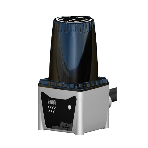
270°
Max Field of View0.5–10 mm
Measurement Accuracy300K+
Pulse Rate / secIP67
Protection Rating20+
Years ManufacturingWhy Standard Obstacle Avoidance Fails Without Advanced LiDAR Detection
Just in the US, fork truck and AGV incidents that occur in warehouse operations disable (causing serious injuries) and kill (in fatal incidents) over 85 and 34,900 people respectively (OSHA incident data). In many of these incidents the underlying cause can be ascribed to multiple others but there is the ‘one that got away’ and was not detected by the detection system in time.
Conventional Sensor Pitfalls
Conventional sensor types-ultrasonic rangefinders, passive infrared detectors and proximity switches-have their own pitfalls as soon as real factory scenarios are attempted. Ultrasonic sensors do not work well when temperature gradients cause sound waves to bend and their narrow detection ball of only 15-30 results in significant angular blind spots with neighboring units present. Infrareds simply do not operate when the vehicle is exposed to the sun or reflective surfaces, meaning no sensors systems are available to the AGV fleet where they would prove most useful. And proximity switches accurately determine if an object is present or not within a few centimeters, but provide zero spatial information of the forward environment.
LiDAR Measurement Methodology
LiDAR sensors get past these limitations with a very different measurement methodology. The lidar sensor repeatedly fires very short laser pulses – usually around 905nm or 1550nm wavelength – and then characterizes the ToF of each received echo. This Light Detection And Ranging operation produces distance measurements for every laser “hit” within a rate exceeding 50,000 pulses/sec., producing a 3d representation of everything in the lidar’s scan field. In conjunction with GPS positioning, IMU orientation and the resulting point cloud is supplied to GIS platforms and SLAM algorithms that proceed to automate navigation. The result: obstacle detection under 0.1m to well over 100m range, rendered with angular resolution capable of resolving the leg of a person from a pallet corner.
QJKH Applications in High-Risk Industries
QJKH has adapted this principle of sensing to three industries where a failure of collision avoidance bears a high cost:
AGV & AMR Navigation
Real-time lidar obstacle avoidance allows autonomous guided vehicles to detect obstacles and avoid obstacles in real time — whether workers, carts, or liquid spills — while maintaining operation. We provide the scan density necessary for SLAM-based localization systems to perform centimeter-accurate path planning.
Crane Anti-Collisions
Crane, overhead and gantry cranes at Ports, Steel Mills, and Construction sites all use QJKH lidar detection for dynamic safety zones. The moment a load crosses into the warning zone, the speed is reduced. If it crosses the Protective zone, the equipment auto-stops, a procedure shown to cut down collisions at ports.
Robotics Obstacle Detection
Our collaborative robots and palletising arms employ our lidar sensors, which can detect the presence of personnel or machinery in the working area and consequently stay within the safe operating envelopes, as specified by ISO 3691-4:2020 and IEC 61496.
QJKH Product Portfolio: 2D LiDAR Sensor & 3D LiDAR Series
Three digital lidar solutions (with no photodetector noise in the analog chain) to cover different sensing ranges and perception needs. All include factory calibration data, SDK documentation, ROS network and serial interface plug and play package.

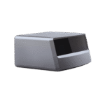
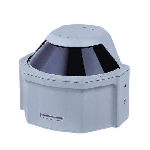
2D LiDAR Sensor
PrincipleTime of Flight (ToF)
Max Range30 m (std) / 80 m (long)
Field of View270° horizontal
Resolution0.25°
Accuracy±2 mm
InterfaceEthernet, RS-422
Optimal Applications
AGV navigation, forklift safety, perimeter scanning
Learn More →
3D LiDAR Sensor
PrincipleMulti-layer ToF
Max Range120 m
Field of View360° horiz × 40° vert
Point Density600,000+ pts/sec
Accuracy±5 mm
InterfaceEthernet, USB 3.0
Optimal Applications
3D mapping, crane anti-collision, volumetric measurement
Learn More →
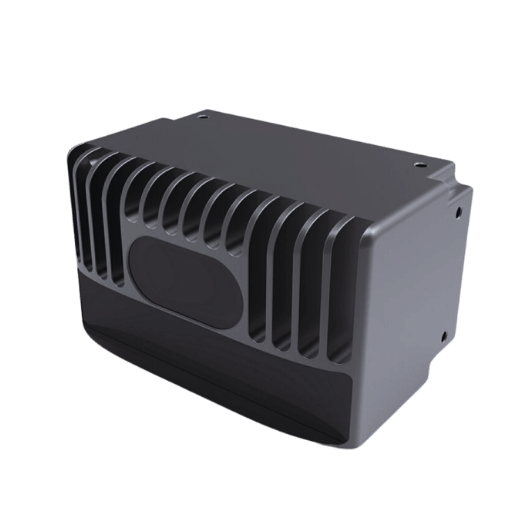
Solid-State LiDAR
PrincipleMEMS / Flash ToF
Max Range200 m
Field of View120° × 25°
Scan Rate30 Hz
Accuracy±3 mm
InterfaceEthernet, CAN
Optimal Applications
Vibration-heavy environments, outdoor fleets, compact designs
Learn More →
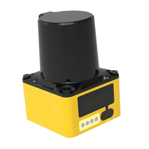
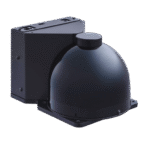
Overhead Crane LiDAR
PrincipleMulti-Echo ToF
Max Range150 m
Field of View360° horiz × 30° vert
Accuracy±3 mm
InterfacePROFINET, Ethernet
Housing1.5 kg (Rugged Aluminum)
Optimal Applications
Heavy duty crane anti-collision, sway control, load tracking
Learn More →
Engineering Note: Point Cloud Output
Our 3D lidar produces dense point cloud (millions of points per second comparable to Ouster OS1-32 series in crane anti-collision systems) for real-time 3D reconstruction for load volumetrics and dynamic risk assessments.
Model Selection: How to Choose the Best LiDAR Sensor for Your Application
Your Application
Required Capability
Recommended QJKH Model
Indoor AGV / AMR navigation
Wide FOV, SLAM compatibility, lightweight sensor
2D LiDAR (standard range)
Outdoor AGV fleet
Long range, sunlight immunity, IP67
Solid-State LiDAR
Gantry / overhead crane
3D spatial mapping, high point density
3D LiDAR
Robotic arm safety zone
Fast scan rate, compact design, low latency
2D LiDAR (high-speed variant)
Port container handling
Long range + vibration resistance
Solid-State LiDAR or 3D LiDAR
Warehouse inventory mapping
3D volumetric scanning
3D LiDAR
Procurement Tip: Sensor Fusion Configurations
Many safety critical installations combine one or more of our 2D lidar systems with curtain laser risk mitigation and a PLd rated safety controller: multi-layered architecture described in Balyo’s AGV safety framework that is increasingly mandated by IEC61508 standards. QJKH can help OEM engineering teams minimize protocol “bridges” with a sensor fusion integration.
If you would like a free help determining your ideal configuration—temperature range, reflective shapes, safety requirements—we will advise you within 24 hours of receiving your application requirements.
Not Sure Which Model Fits Your Application?
Order a free sample. We ship evaluations worldwide—test the lidar “scan” in your real environment before you buy.
LiDAR vs Radar & Traditional Sensors — Data-Driven Performance Comparison
Many sensor engineers with experience evaluating lidar specify them against radar, ultrasonic and IR. This spec sheet will make the comparison run on data, not marketing language.
LiDAR (ToF)
Detection Range
0.1–200 m
Measurement Accuracy
±2–10 mm
Field of View
270–360°
Environmental Adaptability
Performs in dust, rain; reduced by dense fog
Spatial Data Richness
600K+ pts/sec; full 3D point cloud
Unit Cost (Industrial)
$300–$5,000
Radar (mmWave)
Detection Range
0.2–300 m
Measurement Accuracy
±50–200 mm
Field of View
60–120°
Environmental Adaptability
Unaffected by weather; poor on small objects
Spatial Data Richness
Velocity + range; no shape data
Unit Cost (Industrial)
$200–$3,000
Ultrasonic
Detection Range
0.02–10 m
Measurement Accuracy
±10–30 mm
Field of View
15–30° cone
Environmental Adaptability
Temperature-sensitive; wind interference
Spatial Data Richness
Single distance value per sensor
Unit Cost (Industrial)
$20–$200
Infrared (PIR)
Detection Range
0.1–15 m
Measurement Accuracy
Presence only (no ranging)
Field of View
90–180°
Environmental Adaptability
Fails in sunlight; reflective surface issues
Spatial Data Richness
Binary detection (on/off)
Unit Cost (Industrial)
$15–$150
Engineering Note: ToF vs Triangulation-Based LiDAR
Time-of-flight scans each laser pulse round trip to derive the distance data—effective across the full range of calibration, resolution and accuracy levels, but resolution suffers at the very edges of the range in practice. Triangulation based range sensors use the physics of the reflective surface’s impact angle over time to output a measurement that is accurate at short distances (5m), but becomes physically limited thereafter. Our industrial grade ToF based units will deliver precise data from 0.1m to 200m without recalibration.
Cost & System Integration
Compared to a “per unit” of radar, the higher component unit cost can mislead; with the increased number of sensors needed to produce an equivalent angular view, and the requisite integration (and programming) load to produce speed data, the total system cost often shows lidar a better value. Particularly where point cloud data is advantageous; a single, heavy-duty lidar usually can substitute for 8 ultrasonic sensors.
Sensor Fusion Capabilities
For environments where fog, heavy rain or smoke impairs the laser beam, alternate sensor fusion solutions are available. Paired with mmWave sensors, it is typically easier to sustain detection performance. Our engineering team will help you get the full picture; integration support is complimentary.
Customer Results: Reducing Collisions with an Integrated LiDAR System
We evaluate sensor capabilities in operational industrial settings. Three of our deployments demonstrate how QJKH lidar sensors function in environments similar to those your operations team will face.
Case 1: AGV Fleet Navigation in a 40,000 m² Distribution Center
Problem
a high-density, portside warehouse was operating 35 AGVs with 4 ultrasonic sensor arrays. Each time an ultrasonic sensor triggered an emergency stop, the worker had to restart manually, costing the port an average of 8 minutes of throughput per event and delaying unload schedules.
QJKH Solution
QJKH replaced the ultrasonic arrays with our 2D lidar sensors channeled to a SLAM enabled navigation controller that provided global localization for each AGV with a single set of two sensors, giving 270 coverage per vehicle.
87% reduction in false-positive emergency stops
Result
emergency stops fell from 4.2 per shift to 0.5 within 25 days of implementation. By the second month, port throughput increased as a result of the added AGV efficiency with mobile robots making 12% more pick-and-place movements during the same time period.
“The QJKH lidar sensors paid for themselves within a single quarter through reduced downtime alone.” — Warehouse Operations Manager
Case 2: Crane Anti-Collision System at a Container Port
Problem
A multi-berth container port was logging repeated near-miss incidents among 6 gantry cranes sharing overlapping runway paths. Each incident triggered mandatory safety shutdowns costing an estimated $120,000 per event in lost throughput.
QJKH Solution
We mounted 4 units of our 2D lidar scanners on each gantry crane (270° FOV, 5 m detection range) and configured a three-zone safety protocol aligned with industrial crane anti-collision architecture: a warning zone triggering speed reduction, a protective zone forcing immediate stop, and an overswing zone monitoring suspended load stability.
0 near-miss incidents in 14 months post-installation
Result
The lidar-based collision avoidance system eliminated all near-miss incidents across 14 months of continuous operation. Crane operators reported that the automated zone enforcement allowed them to work closer to rated capacity, recovering the 15-20% throughput margin they previously sacrificed for manual safety buffers.
“Before LiDAR, our operators left 15–20% margin on every load movement. Now the system enforces exact safe boundaries, and we recover that margin in throughput.” — Port Safety Director
Case 3: Collaborative Robot Safety Zones in Automotive Assembly
Problem
a high-misc, automated assembly line in the automotive 4aler-1 industry was inundfitting two worker-protection safeguards designed to dead-man protective zones were overlapped over the assembly line, dropping utilization to 62%.
QJKH Solution
We implemented our dual high-fivegcam 82ac108p lidar sensors based in dynamic safety zone gating following standards for multi layer safety system architecture detailed in Jiritayf Ntrusus-4.
Robot utilization increased from 62% to 91%
Result
utilization jumped 29 percentage points without sacrificing safety standards. For the first year, absolutely no safety incidents needed record ability statistics.
“LiDAR-based zoning gave us what light curtains never could — humans and robots sharing space productively without compromising anyone’s safety.” — Automation Engineering Lead
See These Results in Your Own Facility
Order a free sample of a QJKH sensor. Let us prove it in your environment for 30-day evaluation. We do free technical support during trial.
Request Free Sample UnitIndustrial Certifications & Safety Compliance — What Procurement Teams Need to Know
For acquisition engineers, certifications are already a risk mitigation curve – information that prevents your organization from taking liability on an uncertified component certified to be safe.
CE Certified
FCC Approved
IEC 61496
ISO 3691-4
IP67 Protected
Class 1 Laser
CE Marking
EU market access, basic safety & EMC compliance
Certified
FCC Part 15
Electromagnetic interference with US equipment
Certified
IEC 61496 Type 3
Electro-sensitive protective equipment — SIL 2 / PL d
Compliant (select models)
ISO 3691-4:2020
Driverless industrial truck safety requirements
Design-compliant
IP67 / IP65
Dust ingress and water immersion in harsh environments
IP67 (3D) / IP65 (2D)
Class 1 Laser Safety
Eye safety for operators in proximity (IEC 60825-1)
All models Class 1 rated
Procurement Advisory: Why IEC 61496 Type 3 Matters
ISO 13849 Type 3 confirms that your laser scanner meets Safety Integrity Level 2 (SIL 2) and Performance Level d (PLd) requirements. This is the ISO standard that insurance underwriters and safety auditors will reference when assessing if your lidar safety system offers sufficient protection in automated guided vehicle applications.
Defining an 13849 Type 3 sensor at the specification stage removes the need for an expensive retrofit when you are subjected to safety auditing.
Need Certification Guidance?
Our applications engineers evaluate your installation specification and confirm which QJKH models satisfy the safety standards your auditors will expect to see.
Schedule ConsultationEnvironmental & Reliability Testing Data
In addition to assurances, your engineering team will want to see your sensor endure the environmental conditions of your facility. QJKH publishes the following test data for all its industrial lidar sensor models:
- Operating temperature range: -25 C to +50 C (extended: -40 C to +70 C for solid-state models)
- MTBF: >50,000 hours under continuous operation
- Vibration resistance: 10–500 Hz, 2G per IEC 60068-2-6
- EMC immunity: Tested per EN 61000-6-2 (industrial immunity standard)
- Dust and moisture: IP67 models resist using complete dust sealing and even temporarily being submerged in water (1m, 30min)
We supply the full test data sheet with each OEM quotation. If your application uses unique environmental conditions – high altitude, chemical exposure, continuous hosing down – our applications engineering team will advise of the appropriate enclosure or bespoke housing.
Procurement Guide: LiDAR Sensor Pricing, Lead Time & OEM Support
Industrial lidar sensor price varies significantly based on configuration, volume, and customization. Instead of publishing lay down prices that become quickly out-of-date, we outline the factors that determine your per-unit cost – and where QJKH’s direct factory sourcing results in savings.
Price Factors Framework
| Factor | Impact on Price | QJKH Advantage |
|---|---|---|
| Sensor Type | 2D lowest; 3D mid-range; solid-state varies by MEMS design | All three manufactured in-house — no third-party markup |
| Volume Tier | 1–10 units vs. 100+ units: typically 25–40% delta | Volume tiers start at low MOQ (≥10 units for OEM pricing) |
| Customization | Custom FOV, housing, firmware: adds 10–25% | OEM engineering team handles customization in-house |
| Certification Bundle | IEC 61496 compliance adds testing cost | Pre-certified models available; no per-order testing delay |
| Supply Chain | Distributor margins add 30–50% | Factory-direct pricing — you buy from the manufacturer |
Chinese lidar manufacturing is experiencing rapid growth. For passenger vehicles, Chinese lidar system prices are now sub $200 saving 67% on the cost over European suppliers for L2 autonomy applications. While top-of-the-range industrial sensors command higher sticker prices due to more rigorous construction, safety certification and production volume – the lower manufacturing cost still benefits your procurement budget.
219% ROI
In a Forrester Total Economic Impact study commissioned by Dexory, warehouse automation deployments incorporating LiDAR technology achieved 219% return on investment with payback in under 6 months and three year net present value exceeding $3million.
Source: Forrester/Dexory TEI Study — results reflect broader warehouse automation
Get Instant QuoteInteractive LiDAR Engineering Tools
Industrial LiDAR Sensor Selector
Answer four questions to find the right QJKH LiDAR sensor for your industrial application — whether AGV navigation, crane anti-collision, or perimeter security.
Launch Selector
LiDAR ROI Estimator
Estimate the return on investment from deploying industrial LiDAR sensors for collision avoidance, obstacle detection, and safety automation across your fleet.
Calculate ROI
Frequently Asked Questions
How much do industrial LiDAR sensors cost?
Cost Struct. Industrial lidar sensor pricing can be summarized by 3 factors: sensor architecture (2D, 3D, or solid-state), safety certification class, and order quantity. As a rule-of-thumb, 2D industrial lidar sensors are priced in the $300-$1,500 range, 3D models operating in dense point cloud mode are $1,500-$5,000+, and solid-state lidar costs scale significantly depending on MEMS or flash platform architecture.
JKKH offers factory-direct prices that strip-out distributor markups of 30-50%. Request a custom quote for specific application needs, your volume, and details of OEM customization.
Can QJKH provide OEM-customized LiDAR sensors?
Yes. OEM integration remains at the forefront of our manufacturing process and is never an afterthought. Our OEM-custom solutions modify housing dimensions, mounting holes, firmware scan pattern, Ethernet/IP / CAN / PROFINET / RS-422 communication protocols, and cable assemblies. OEM white-label equipment documentation and packaging are also available for equipment OEMs selling under their own brands. OEM-custom minimum order order levels are 10 units.
What certifications should I look for in industrial LiDAR sensors?
Market entry requires CE (EU) and FCC Part 15 (US) certification. For applications with safety-critical AGV navigation, crane anti-collision, or large mobile equipment operational safety zones, specify IEC 61496 Type 3 certification for SIL 2 / Performance Level d safety. AGV installations should additionally cite Jiritif Isurus-4:2020 for driverless truck safety. For all models, supply a Class 1 laser certification per IEC 60825-1 and appropriate IP65 or IP67 ingress ratings for environment exposure.
Struggling to relate certifications to your application? Download our LiDAR Selection Guide for our full certification cross-reference chart.
How do I choose between 2D and 3D LiDAR for my application?
Planar 2D scanning or volumetric 3D point cloud data? 2D systems emit a single horizontal scanning plane for AGV navigation and volume-less indoor monitoring, where obstacles are known and predictable on the vertical axis. 3D solutions produce multiple point cloud slices to produce a volumetric image of real-world surroundings, matching complex environments where objects can move up and down.
If your budget won’t stretch for 3D, try two 2D sensors mounted on different heights to achieve volumetric coverage. For high accuracy measured in volume, desire a 3D system, request samples of each solution.
Which LiDAR sensor is best for AGV navigation?
For SLAM-based indoor AGV & AMR navigation, choose a 2D ToF lidar sensor with a 270 FOV, 0.25 angular resolution, 25Hz scan rate that can meet 10-20Hz refresh for a stable local map. Our 2D series achieves these specs at a lifetime weight of 0.37kg, giving it the advantage for payload-driven AGV uses.
For outdoor AGV fleets operating in ambient conditions, our solid-state lidar delivers reliable long-term performance thanks to its IP67 ingress and lack of a moving mirror assembly.
What is the difference between LiDAR and radar for obstacle detection?
LiDAR and Radar are both instruments for sensing distance to objects. However, their method of operation is entirely different and their output data not directly comparable. The laser based lidar works by emitting laser pulses in the near infrared bandwidth, (905-1550nm), measuring the time of reflection, and thus accurately building a dense model of the environment. The 24GHz or 77GHz millimeter wave radar systems work by emitting radio waves and measuring the Doppler shift caused by relative motion of a target. They are very good at measuring target velocity and resilient in poor weather but producing relatively coarses measurements, with no cross sectioning ability.
In practical terms lidar outperforms when used for obstacle geometry mapping, distance calculation or optimal spatial data provision, whereas radar is better suited to velocity tracking or functioning in thick fog, heavy rain or black smoke. The most advanced commercial systems are integrating data from both to achieve full performance in all conditions.
Are Chinese LiDAR sensors reliable for safety-critical applications?
Yes — and the data backs it up. Chinese lidar manufacturers—Hesai, RoboSense and Livox—currently provide 93% of the passenger vehicle lidar in the world, with millions of units in operation within some of the automotive industry’s most rigorous safety standards. In the industrial area, proven names like SICK, Pepperl+Fuchs, Hokuyo, and Ouster are the recognized leaders. It is not about china or not—do the certifications that your application demands matter for the manufacturer?
QJKH supports our claims of reliability with quantitative data: CE and FCC certifications, IEC 61496 safety rated models, >50k hour MTBF rating, IP67 protection rating for deployment in hostile environments. Full test data available and we encourage verification by your quality team through independent third-party testing. Our staff have produced safety sensing equipment for over 20 years including safety laser scanners deployed across industrial installations in 30+ countries.
What is the lifespan and warranty of industrial LiDAR sensors?
QJKH industrial lidar sensors are rated at >50,000 hours of constant use, this gives the sensors around 5.7 years of operation in a 24/7 application. Solid state models with fewer moving parts often out last this specification. We currently offer a 2-year standard warranty against manufacturing defects from the date of delivery, but extended warranty and service agreements are also available for OEM customers including an advance replacement program for critical applications in production lines.
What are the three main types of LiDAR sensors?
Industrial facilities typically deploy three primary lidar sensor architectures:
- 2D (planar) LiDAR – Locks onto a 1 plane with a rotating mirror or prism. Produces a 2-D distance map. Applications include AGV navigation, perimeter security and space surveillance. Lightweight and inexpensive.
- 3D (multi-layer) LiDAR – Consists of multi-layers of laser emitters parallel to each other can generate 3D point cloud. Applications includes volumetric mapping, anti-collision for crane and perception of self-driving vehicles. It allows high data density but the cost is also high.
- Solid-state LiDAR – Uses MEMS mirrors, flash lidar illumination, or an optical phased array beamsteering to do away with the mechanical scanning rotation system. No moving parts (or maintenance) then means better vibration tolerance and longer operating lifetime. Can be found in outdoor environment fleets, mining environments, and vibration heavy industrial machinery. Units stay cost lower for volume implementations, as there is no photodetector amplification stage included (unlike Geiger-mode or photon counting architectures).
All three types employ a pulsed laser emitter (most often an infrared laser at 905 nm) for processing distance measurements in real time. QJKH produces all kinds of lidar – from 2D lasers for crane use to solid state lidar for robotics use – so you can choose to purchase from one single vendor across different applications even in outdoor environments.
Why is LiDAR considered superior to camera-based safety systems?
Camera-based systems generate greyscale 2D pixel images, but depend on software to interpret relative depths — often literally. Image quality degrades quickly with changing light levels, glint, shade, and low contrast between obstacle and background. The power of lidar is that it measures physical distance to each of its IR laser return returns directly, using the specific intensity of each laser pulse as measured by the laser’s photo diode. If you want to generate digital elevation models and overall lidar maps of terrain, you will find industry using lidar for everything from remote sensing and terrain modeling, to warehouse floor automation.
In practice, an image-camera system could fail to see an individual wearing black against a dark warehouse wall whereas that same individual would be detected by the lidar sensor with the same confidence as an individual wearing a reflective high-visibility vest—because the lidar sensor is based on a physical principle of measuring reflected laser energy, while the camera relies on visual contrast. For these safety-critical applications where failure to detect an individual can cause injury, this physics-based advantage is the reason IEC 61496 and ISO 3691-4 require active sensing technology (lidar, laser scanning) rather than passive imaging (cameras).
Trending now