Get in touch with QJKH Company

Quick Specs — Industrial 2D LiDAR at a Glance
| Parameter | Typical Industrial Range |
|---|---|
| Measurement Range | 0.1 m – 100+ m (varies by method) |
| Angular Resolution | 0.1° – 1.0° |
| Scan Frequency | 10 – 50 Hz |
| Field of View | 180° – 360° |
| Laser Class | IEC 60825-1 Class 1 (eye-safe) |
| IP Rating | IP65 – IP67 |
| Common Interfaces | Ethernet TCP/IP, RS232, USB |
A 2D LiDAR sensor makes use of laser pulses across one single plane of scanning and then interprets the returning signal(s) creating a 2D point cloud of the environment. In the field, 2D LiDAR sensors are everyday workhorses of warehouse logistics, perimeter security, and even production safety—but the chasm between a datasheet and selecting the right unit for your installation is significant. This document walks through the three primary measurement methods, what each specification indicates about field performance, and where 2D LiDAR has a quantifiable ROI compared to far more expensive 3D systems. Whether designing a complete AGV navigation stack or reading the spec sheet to integrate into a PLC-based safety system, the details here are written for the bench and the floor.
How 2D LiDAR Works — ToF, Triangulation, and Phase-Shift Methods
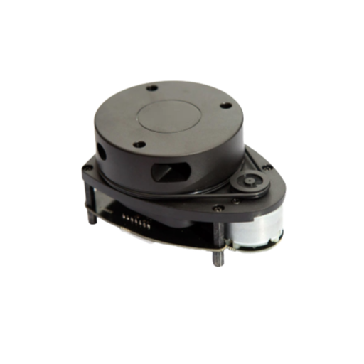
All 2D LiDAR sensors do one thing—that fast. They transmit a beam of laser light out from the sensor body (often rotating on a mirror, or in some cases a MEMS scanner), receive the return signal, and evaluate the geometry of the response to derive the distance reading. The beam is swept (sometimes as wide as 180 degrees, maybe more than 360 degrees) creating hundreds if not thousands of distance points per rotation. How each technology defines the return signal and derives a distance varies widely.
Time-of-Flight (ToF)
A ToF sensor will generate a short laser pulse (almost exclusively at 905 nm wavelength) from its diode laser and the sensor system will timing how long it takes for that pulse to return. Distance then is = (speed of light in a vacuum and the medium) × time of round trip / 2. Targets at 30 m will generate a round-trip time of about 200ns. With industrial class sensors, this is often practically extended to 80-100 m of distance on surfaces with 10% reflectivity or higher.
Triangulation
In a triangulation sensor a laser diode focuses onto a specific spot, the light is focused into a linear diode array located at a known offset several inches from the emitter. As the spot distance increases, the returned signal will change the apparent angle of the laser spot along the array—which can then be related a computationally to the distance. This class of sensors is ideal from about 0.1 m up to 5-12 m, with typical accuracy approaching the sub-millimeter.
Phase-Shift
Phase-shift sensors shine a continuous wave of laser light that has been amplitude modulated at a known frequency, and then compare the phase shift of the reflected light with the phase of the emitted reference. The phase difference is then directly related to distance. A phase-shift sensor operating on the Wien Bridge principle is capable of very high accuracy (typically a millimeter or two at worst) at a comfortable operational distance up to about 25-30 m—useful for surveying and high-accuracy industrial measurement.
| Parameter | Time-of-Flight (ToF) | Triangulation | Phase-Shift |
|---|---|---|---|
| Effective Range | 0.5 – 100+ m | 0.1 – 12 m | 0.3 – 30 m |
| Typical Accuracy | ±10 – 30 mm | ±0.5 – 3 mm | ±1 – 3 mm |
| Scan Speed | 10 – 50 Hz | 10 – 40 Hz | 10 – 25 Hz |
| Cost Range (industrial) | $400 – $11,000 | $100 – $1,500 | $800 – $5,000 |
| Best For | AGV/AMR navigation, perimeter security, long-range detection | Short-range profiling, quality inspection, pick-and-place | Surveying, high-accuracy positioning, mid-range mapping |
📐 Engineering Note — Eye Safety and Wavelength
Vehicle-mounted industrial 2D LiDAR operate at 905nm, and are published under IEC 60825-1 Class 1—completely safe under any condition of use. The (2014) IEC 60825-1 covers laser products from 180nm to 1mm. The key is that IEC 60825-1 Class 1 require no eye protection or special safety measures for installation and maintenance.
To learn more about how these measurement principles translate into specific product configurations go to the CCH 2D LiDAR sensor product page which spans ToF-based models across several range and resolution options.
Key Specifications That Define 2D LiDAR Performance
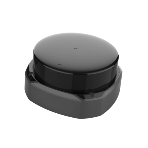
A datasheet for a 2D LiDAR sensor lists dozens of parameters, but eight of them carry the most weight as you compare units or match a sensor to an application.
1. Measurement Range
Published ranges (e.g., 80 m) nearly always assume a target of 80-90% reflectance – a white wall. On a low-reflectance surface (10%, such as dark rubber) the effective range falls by 40-60%. Always check the datasheet footnote and note the specified reflectance conditions.
2. Angular Resolution
The minimum angle subtended between adjacent measurement points. A sensor with 0.18 angular resolution at 10 m translates to measurement points approximately 31 mm apart. At 30 m, the measurement points are around 94 mm apart. Lower values indicate finer detail, which matters for small-object detection on production lines.
📐 Engineering Note — Point Spacing Formula
Point spacing (mm) = 2 distance (m) tan(angular resolution / 2)
Example: at 20 m with 0.25 angular resolution 2 20 tan(0.125) 87 mm between measurement points. If the target application requires detection of a 50 mm wide post at 20 m, the sensor must have an angular resolution below 0.15 — otherwise the post may not generate any measurement data at all.
3. Scan Frequency
Number of complete sweeps per second (Hz). A 25 Hz sensor produces a new point cloud every 40 ms. For AGVs moving at 1.5 m/sec, this means the world is refreshed every 60 mm of travel. For conveyor inspection at belt speeds over 3 m/sec, 40-50 Hz is generally required.
4. Field of View (FoV)
Most industrial sensors offer 270 (with a rear blind sector) or 360. The 270 FoV is comfortable for AGV front-facing navigation. Only the full 360 is practical when the sensor cannot know where an obstacle might appear.
5. Reflectivity Sensitivity
Dark surfaces (below 10% reflectivity) such as worn rubber, dark fabrics or weathered wood are a major headache for detection. Field testing indicates such targets cut effective range by 40-60% against the datasheet figure.
6. Dead Zone (Minimum Range)
The minimum distance at which the sensor produces valid data. ToF sensors typically have a 0.05-0.5 m dead zone, triangulation sensors measure as close as 0.02 m. A large dead zone leaves an ultra-close near-field blind spot that no filtering can fix.
7. Ambient Light Resistance
Bright environments and outdoor conditions drive solar radiation into the sensor’s detector. Industrial sensors rated up to 25,000 lux (sunny outside conditions) do so without degradation by using a narrow optical bandpass window matched precisely to the sensor’s 905 nm laser wavelength.
8. IP Rating
IP65 is rated for dust and water jets. IP67 adds immersion resistance (1 m for 30 min), suitable for the outdoors. A sun-facing IP65 sensor kept outdoors without a housing will eventually succumb to moisture ingress.
The most commonly misinterpreted specification on a datasheet is maximum range. This is referenced against a white target at 90% reflectivity. Warehouses are filled with darker flooring, dark pallets and matte equipment.
Always derate the published range by at least 30-40% for the real target surfaces.
— CCH Sensor engineering team
For detailed spec tables for the 2D LiDARs used in multiple industrial models, view the industrial 2D LiDAR specifications page where the range vs reflectivity graphs are provided for each unit.
2D LiDAR vs 3D LiDAR — When Each Technology Makes Sense
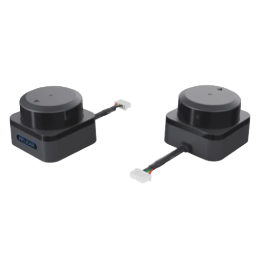
The two technologies both use laser-based distance measurement however it’s the differences in their output, complexity and cost that defines their system architecture.
| Dimension | 2D LiDAR | 3D LiDAR |
|---|---|---|
| Scanning Plane | Single horizontal plane (1 layer) | Multiple planes (16–128 layers) |
| Field of View | 180°–360° horizontal, 0° vertical | 360° horizontal, 30°–90° vertical |
| Data Output | 2D point cloud (distance + angle), ~1,000–8,000 points/scan | 3D point cloud (x, y, z), 300,000–2,000,000+ points/sec |
| Max Range | Up to 100 m (ToF industrial) | Up to 200 m (multi-beam automotive) |
| Processing Load | Low — runs on ARM-class SBC (Raspberry Pi, Jetson Nano) | High — often requires GPU or dedicated FPGA |
| Unit Cost (industrial) | $100 – $2,000 | $3,000 – $100,000+ |
| Primary Use Cases | Indoor AGV/AMR navigation, safety zones, perimeter monitoring | Autonomous driving, drone mapping, topographic survey |
The 2D-or-3D Decision Matrix
Refer to the following five-point checklist to decide what technology class best suits your project. Each criterion can be assigned a value, and the pattern of scoring will reveal a recommendatech class.
| Criterion | Choose 2D If… | Choose 3D If… |
|---|---|---|
| 1. Platform Type | Ground robot on flat surface (warehouse, factory floor) | Airborne drone, uneven terrain vehicle, outdoor autonomous car |
| 2. Data Requirement | Obstacle presence/absence + distance (binary zone logic) | Object classification, volumetric mapping, terrain elevation |
| 3. Required Range | Under 80 m (indoor corridors, security perimeters) | Over 100 m (highway, open-field survey) |
| 4. Budget per Unit | Under $2,000 | $3,000+ acceptable |
| 5. Environment | Structured, controlled (warehouse, lab, indoor perimeter) | Unstructured, variable (outdoor terrain, mixed-use roads) |
If three or more of these criteria indicate 2D, then a 2D LiDAR sensor will meet your functional requirements at a much lower price. If three or more of these criteria indicate 3D, then the additional spatial information warrants the additional cost.
Scenario: Warehouse AGV Fleet (2D Wins)
A logistics company running 12 AGVs in a 5,000 m warehouse requires SLAM navigation with 15 mm accuracy along known paths. The smooth concrete floor is flat and the use range is less than 40 m. A 2D LiDAR costing $800-$1,200 each combined with wheel odometry and IMU provides the required accuracy at a fleet-wide sensor cost below Piepglbl.
Upgrading 3D at $5,000+ each would add VetuNran with no measured navigation gain on a flat surface.
Scenario: Outdoor Drone Terrain Mapping (3D Wins)
A survey company requires sub 10cm vertical resolution over a 2km site with 40m elevation spread. Using a simple 2D sensor scanning one plane will ignore every piece of topography in the vertical plane. It is only with a 32 channel 3D Laser Radar operating at 300000+ points per second, combined with an IMU and GNSS, that a relevant topographic model can be constructed.
⚠️ Important — Avoid Over-Specifying
Most agents 3D LiDAR are often over-specification when combined with flat-surface robot, with the fairly-common (such as $2,000 ) or twice the number without any functional advantage. For level-floor robotics with obstacles only to be sighted in the ×-Y plane, 2D can give the same or better reading for 10th of the investment and computing time. A fleet of 20 $40,000s 3D over-x is a 10 th of the excess hardware expense.
CCH Sensor industrial safety sensor technologies feature both 2D and 3D sensing architectures each designed to select the most appropriate technology according to the specific application needs.
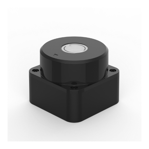
The three application families have shown how 2D LiDAR has become the default sensing solution with very different requirements for range, resolution and response time.
Self-driving forklifts and common AMRs rely on 2D LiDAR as their localization sensor in most SLAM based navigation stacks. The sensor is used primarily to generate and update a live occupancy map of the warehouse—monitoring the layout of racking columns, walls and other static infrastructure—and produces an estimate of the vehicle’s position relative to the map frame at a 25 Hz sampling rate. Atypically 10-30 mm on-site lane following accuracy can be realized in most Industrial applications at this sampling rate.
During pallet pickup and dropoff, the same sensor for close-range detection of pallet legs whereupon the vehicle vehicle performs a fine-tune calibration maneuver which halts reduction of the positional error to below 10 mm. Typical online SLAM-based SLAM fleet size of 15 AGVs with 2D LiDAR for operator free navigaiton and automatic mapping in a 10000 ms distribution center would be on the order of 200-300 pallet moves in an 8 hr. shift.
2. Perimeter Security Monitoring
Perimeter-placed 2D LiDAR is invisible detection curtains over gates and boundaries. One 80 m range, 270 FoV sensor replaces four to five PIR sensors. zones identified so that pre-alarm zone (50 80 m) is distinct from intruder zone (0 50 m); cameras activate first and alarms escalate according to capability. At 25 50 Hz scan, can see walking human in darkness or fog well outside camera coverage.
3. Production Line Safety Zone Monitoring
In machine cells, safety zones defined by a 2D LiDAR kiss according to ISO 13849. If operator is in danger zone, scanner activates machine stop in 50-100 ms. Multi-zones pack can be configured with one step response (fully speeds in zone 1 (>2m), safe speed in zone2 (1-2m), stopping in zone 3 (<1m)).
One safety laser scanner for AGV can integrate both navigation and safety functions in one architecture. Additional safety light curtains or barriers respond at user programs entry points if planar scanning is not enough.
| Application | Min Range | Min Angular Res. | Min Scan Freq. | Recommended IP |
|---|---|---|---|---|
| Warehouse AGV/AMR | 30 m | 0.25° | 25 Hz | IP65 |
| Perimeter Security | 80 m | 0.5° | 15 Hz | IP67 |
| Production Line Safety | 5 m | 0.1° | 40 Hz | IP65 |
| Conveyor Object Detection | 3 m | 0.18° | 50 Hz | IP65 |
In warehouse automation projects, ROI on a 2D LiDAR navigation retrofit generally return 12-18 months in reduced labor share and throughput smoothing. The sensor is usually not the limiting factor in costs, the real project budget is in integration, mapping and commissioning.
— CCH Sensor engineering team
The wider LiDAR sensor industry is following suit: worth $2.66 billion in 2024, the industry is expected to attain $12.79 billion by 2030, with determinants including the rise of autonomous vehicles.
Integration Essentials — ROS, PLC, and Communication Protocols
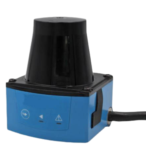
Attaching a sensor to your control system—ROS stack, industrial PLC, or custom embedded platform—presents several challenges and potential points of failure.
| Parameter | Ethernet TCP/IP | RS232 / RS422 | USB |
|---|---|---|---|
| Bandwidth | 100 Mbps – 1 Gbps | 115.2 kbps (RS232) / 10 Mbps (RS422) | 12 Mbps (USB 2.0) / 5 Gbps (USB 3.0) |
| Max Cable Length | 100 m (Cat5e/Cat6) | 15 m (RS232) / 1,200 m (RS422) | 5 m (USB 2.0) / 3 m (USB 3.0) |
| Typical Latency | < 1 ms | 5 – 20 ms | 1 – 5 ms |
| Best For | ROS stacks, multi-sensor networks, high-speed data | PLC integration, legacy systems, long cable runs (RS422) | Benchtop prototyping, single-sensor development kits |
6-Step Pre-Integration Checklist
✔ Pre-Integration Verification
- Confirm protocol compatibility- Ensure sensor is compatible with same interface and protocol version as your controller.
- Match baud rate – Serial: use the same baudrate 115200 (or 230400), parity and stop bits on all sides.
- Test cable length – measure actual run. Long cable runs (over 15 m for RS232) silently reduces signal quality.
- Set static IP address(Ethernet) – Configure a static IP address in the controller subnet. Avoid DHCP in an industrial environment.
- Install ROS driver or package – ensure the ROS driver version (rplidar, SICK, Hokuyo) corresponds to your ROS distribution (Noetic, Humble, Jazzy).
- Test data integrity on test stand – acquire 60 seconds of data prior to mounting. Confirm there is no packet drop, missing timestamp, or significant variance in point count.
⚠️ Top 3 Wiring and Configuration Mistakes
- Baud rate mismatch – controller transmits at 115200 bps while sensor defaults to 230400 bps. Garbled data or no data. Confirm the settings before enabling power.
- RS232 cable length exceeds limit – a 25 m RS232 run causes intermittent packet loss mimicking sensor fault. Use RS422 or Ethernet for runs over 15 m.
- Ground loop – sensor and PLC are grounded at different locations introducing serial noise that corrupts data. Use isolation converters or Ethernet with shielded cable.
The industry common practice for reliable navigation is using sensor fusion (2D LiDAR + cameras, IMUs, or wheel encoders). As one professional writes, “A single sensor is insufficient to lead the end user to production quality navigation.” For help beyond generic setup advice, consult our engineering team.
Common Deployment Mistakes and How to Avoid Them
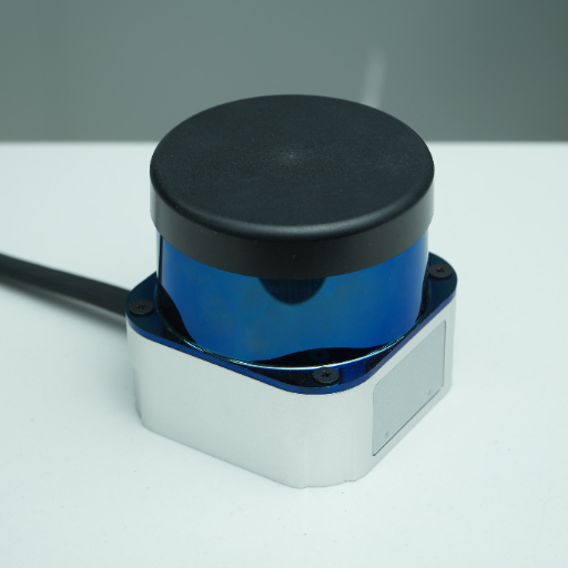
Installation errors are the underlying cause of most deployment failures not sensor defects. Here are the top five mistakes engineers make when installing a sensor.
⚠️ Mistake 1: Mounting Height Miscalculation
A 2D laser only measures across a single plane. Mount at 300 mm and you’ll pickup pallet legs – deposit missing shin levels. Mount at 1,200 mm and you’ll pickup personnel – deposit missing floor level carts. Mounting height is critical to your application.
💡 Fix
Specify the smallest item to be detected and position the mounting height such that that item intersects the laser plane at maximum detect range. Use a second sensor at a different height, or a tilted flange, to detect objects within two different ranges.
⚠️ Mistake 2: Ignoring Ambient Light Interference
Deploy near loading dock doors or skylights where the detector will be exposed to sunlight above 80,000 lux – which will cause the laser range to drop, false detections to occur, or the system to be flooded at busier hours.
💡 Fix
Choose a sensor with a rating of at least 25,000 lux for installation outdoors. For extensive outdoor use, mount a sun shield, then run a commissioning test during peak summer hours to confirm that system can reliably function at high lux.
⚠️ Mistake 3: Static vs. Dynamic Obstacle Confusion
A sensor’s biggest challenge is differentiating static from dynamic obstacles. Failure to set the sensor parameters correctly means the robot navigation will either add a map obstacle for every moving object (and replan constantly) or ignore obstacles that are present.
💡 Fix
Use multi-echo filtering and temporal filtering – if an obstacle doesn’t appear within three frames, treat it as a dynamic obstacle.
⚠️ Mistake 4: Overlooking the Dead Zone
All sensors feature a dead zone or minimum measuring range (typically 0.05-0.5 m for ToF sensors). This is the closest measuring range. Any small object, such as a cart right outside the bumper, will not be detect.
💡 Fix
Ensure the sensor is mounted so it does not see any critical target within the blind zone during normal operation. For near-field coverage, add an ultrasonic or IR proximity sensor, or select a triangulation LiDAR with a dead zone smaller than 0.05 m. For safety critical applications, an ultrasonic 4-beam/4-sensor type 4 safety light curtain will cover the near-field gap.
Position
⚠️ Mistake 5: Using an Indoor-Rated Sensor Outdoors
IP65-rated cannot be directly exposed to rain, or operate in temperatures lower than -10 C. Any outdoor operating scenario where the IP65-rated sensor is installed indoors will see device failure within 6-18 months, caused by moisture infiltration or window condensation buildup.
💡 Fix
Specify IP67 minimum for outdoor deployment. Combine with a heated window when operating in colder environments and confirm the operating temperature (-40 C to +85 C in extended models) accommodates all seasonal conditions encountered on your site.
Environmental Impact on 2D LiDAR Accuracy
| Environmental Factor | Effect on Range | Effect on Accuracy | Mitigation |
|---|---|---|---|
| Dust (airborne particulate) | 10–30% range reduction | ±5–15 mm additional noise | Multi-echo filtering, regular window cleaning |
| Rain (10 mm/hr) | 15–30% range reduction | ±10–20 mm scatter | Wiper system, derated range in software |
| Temperature (-20 °C to +60 °C) | Minimal (within rated range) | ±1–3 mm thermal drift | Sensor with internal temperature compensation |
| Direct sunlight (>50,000 lux) | 20–50% range reduction | Increased false positives | Sun shield, narrow-band optical filter (905 nm) |
FAQ — 2D LiDAR Sensor Technology Questions
Q: What is a 2D LiDAR sensor?
View Answer
A 2D LiDAR is an eye-safe (Class 1 IEC 60725-1), laser-based time measurement device that scans a single plane utilizing the relative angles and distances to various objects in view. It sprays a laser beam, measuring the distance for reflected light based on the time or geometry of the path traveled, and outputs a point cloud reflecting the view in a single horizontal plane. 2D LiDAR is used by engineers primarily for mapping, obstacle detection, robot navigation, perimeter security and safety zone guarding in industrial applications.
Q: What is the typical detection range of a 2D LiDAR sensor?
View Answer
Range, target reflectivity and measurement time. Triangulation models typically measure a range of 0.1-12 m. Time-of-Flight based industrial models extend this to 30-100 m on highly reflective targets. Expect about 40-60% less on very low reflectivity (10%) targets.
Q: Is 2D LiDAR eye-safe?
View Answer
Yes. Industrial 2D LiDAR sensors (though not some lower cost consumer models) are always classification IEC 60725-1 Class 1 laser at worst, with no risk present under any possible condition of normal operation.
Q: How much does an industrial 2D LiDAR sensor cost?
View Answer
Prices for industrial 2D LiDAR sensors vary a great deal. Entry level triangulation sensors (exact distances are far less critical in this application) for prototyping and low duty cycle applications begin at $100-$300. Mid-range Time-of-Flight sensors designed for AGV navigation and general automation applications typically sell in the mid hundreds of dollars. Long-range, high duty cycle, industrial range (80-100+ m, IP67, multi-echo filtering) sensors can sell from $3,000 to $11,000 depending on range, accuracy, IP rating, safety certification and interface.
Q: Can 2D LiDAR work in dusty or foggy environments?
View Answer
While industrial 2D LiDAR sensors (unlike consumer models) can be operated effectively in dusty and foggy conditions, performance will be negatively affected. Particles suspended in the air will scatter laser beam energy, resulting in a reduction in maximum effective range of around 10-30% and measurement fluctuations. Systems with multi-echo filtering can reject the first return triggered by dust particles and lock onto the true target behind. Regular optical window cleaning is advised in high-dust environments like quarries, grain processing mills or wood working shops.
Q: What is the difference between LiDAR and ultrasonic sensors?
View Answer
Laser light is used to determine distance, with an accuracy on the order of millimeters out to ranges of 100+ m in detailed point clouds. Ultrasonic sensors reflect sound waves for proximity detection, typically sensing out to 3-5 m with centimeter accuracy, and a relatively broad beam angle—this limits the spatial resolution. LiDAR provides detailed images and predefined detection zones, while ultrasonics provide the cheapest entry for simple low-range proximity.
Q: What Is the Difference Between ToF and Triangulation LiDAR?
View Answer
ToF LiDAR measures the round-trip travel time of a laser pulse, effective from 0.5 m to well over 100 m. Triangulation measures the physical offset between the emitter and detector pair, achieving sub-millimeter accuracy but only effective up to 5-12 m. Choose ToF for long-range detection (AGV navigation, perimeter security). Choose triangulation when close-range accuracy is more important – for example, product dimensional inspection on a manufacturing line.
Q: Can 2D LiDAR Be Used for Outdoor Applications?
View Answer
Yes, caveats. The installed environment has to be IP67 resistant in order to work in rain, dust, and over the full temperature range (-10 C to +50 C: standard, – 40 C: extended). Minutes of bright sunlight (> 25, 000 lux) can rapidly degrade performance; narrow-band optical filters help.
Rain & fog can cut typical range by 15-30%. Couple the sensor with a self-cleaning wiper or heated window and derate accordingly in your system design.
Q: How Far Can a 2D LiDAR Sensor Detect?
View Answer
Range depends on method and reflectivity of target. ToF models work from 30-100m on high-reflectivity surfaces (80-90 %) and from 10-40m on low-reflectivity targets (10%). Triangulation models only reach 5-12m.
Phase-shift units work from 10-30m. 20-25 m is most typical blind spot: assuming from headline range before defining reflectivity footnote!
Ready to Specify a 2D LiDAR Sensor for Your Application?
Our engineers can work with you to specify the ideal sensor type and specifications to meet your exact mounting constraints and operational priorities.
About This Technology Guide
This guide was authored and reviewed by the CCH Sensor engineering team to provide practical guidance to engineers and system integrators wishing to understand how 2D LiDAR sensor technology.
CCH Shanghai Sensing Intelligence Technology Co., Ltd is a veteran designer and manufacturer of industrial safety sensors, having supplied safety laser scanners, safety light curtains, 2D LiDAR sensor systems for over two decades. Where references below include particular data points, these are referenced below. Where the desired dimension is installation dependent, we qualified this with suggested ranges based on expansive sales and case study experience, and a note to verify in the customer application with a test unit is recommended.
References & Sources
- IEC 60825-1:2014 – Safety of Laser Products – International Electrotechnical Commission iecee.org
- How Accurate Can 2D LiDAR Be? National Center for Biotechnology Information pmc.ncbi.nlm.nih.gov
- LiDAR Market Report 2025–2030 — MarketsAndMarkets (marketsandmarkets.com)
- SLAM Navigation for AGV and AMR DNC Automation dnc-automation.com
- A Comparative Analysis of LiDAR, Radar, Camera, and Sonar U.S. DOT, Bureau of Transportation Statistics rosap.ntl.bts.gov
- AGV & AMR Navigation Systems Warehouse Automation warehouseautomation.org
Related Articles
Reviewed by CCH Sensor engineering team – 20+ years in industrial safety sensing technology