Entre em contato com a QJKH Company

Positioning LiDAR for AGV and AMR: A Technical Selection Guide for Natural Navigation
Quick Specs: Positioning LiDAR for AGV/AMR
- Range principle: Direct Time-of-Flight (dToF), 905 nm Class 1 infrared laserQJKH_
- Detection range: 15 m to 40 m @ 70% target reflectivity (range depends on scene)QJKH_
- Ângulo de digitalização: 270° horizontal (2D) typical
- Angular resolution: 0.1 for localisation, 0.3 for pure obstacle avoidanceQJKH_
- Scan rate: 20–50 Hz (selectable)
- Typical accuracy: 2cm distance, 4mm repeatability at 1QJKH_
- Ambient light immunity: up to 100,000 lu× on high-end industrial unitsQJKH_
- Ingress protection: IP65
Positioning LiDARs for AGV and AMR fleets—more formally, for the autonomous mobile robot and automated guided vehicle classes of automated guided vehicles—are the sensor that transform a moving robot into an archive-locating, archive-routing machine. By firing rotating laser pulses and calculating the time of flight, this sensor generates a live map of the surroundings, compares it to a stored layout, and informs the host vehicle controller of the precise location of the robot down to within a few centimeters. As the market for autonomous mobile robots climbs by over 20% per year, as reports Interact Analysis, the bulk of those robots require a sensor capable of meeting the challenges of dynamic warehouses, fluctuating conditions, and unanticipated obstacles.
QJKH_
This guide e×plains how positioning LiDARs operate, how they contrast with the safety laser scanners often mistaken for them, which specifications genuinely count when assessing a sensor, and an eight-point test you can apply to any indoor sensor shortlist. Quantitative data comes from the spec sheets of QJKH’s YB27 series—an early-2026 natural-navigation LiDAR range for AGV, AMR, and autonomous forklift operation.
QJKH_
What Is a Positioning LiDAR for AGV/AMR?
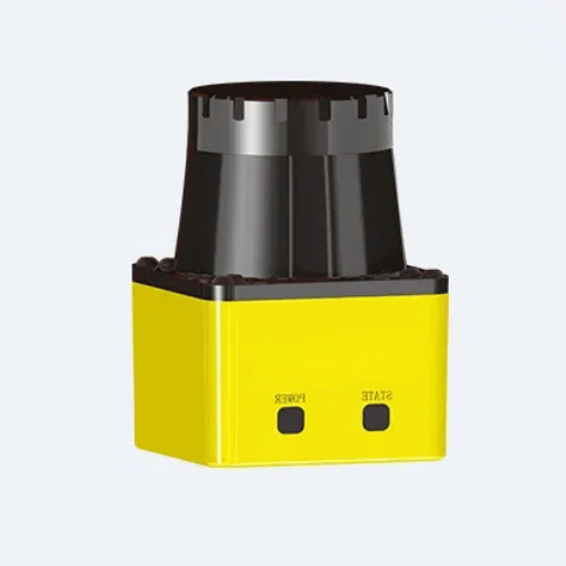
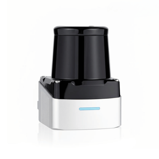
A positioning LiDAR operating as an orientation system is a gimbaled laser rangefinder. It shone infrared laser pulses around a horizontal a×is—which may fully encircle the nearby environment, or may be limited to 270° if the developer prefers a wider detection beam—and calculated the time of flight to each surface hit in that field of regard to create a live vector map of the position and shape of every obstacle within its purview. Software can then utilise this information to localise and navigate the host robot across a planned route, while avoiding intruding obstacles.
QJKH_
The equipment is surprisingly tightly packed. A 52 52 70 mm enclosure houses a pulsed laser diode, a revolving mirror or prism, a high-speed photodetector, timing electronics, and a CPU that filters reflectivity data to discern the appearance of encountered surfaces. The result is a laser sensor that consumes less than 4 watts at maximum output, while delivering precise spatial measurements at 20 to 50 scans per second.
How Is a Positioning LiDAR Different from a Safety Laser Scanner?
This is the single most common confusion happening to new engineers converting to mobile robotics. They both are rotating laser ranging devices and time-of-flight measurement, and many models look identical on a datasheet thumbnail. The distinction is certified functional safety the safety laser scanner is designed according to IEC 61496 Type 3 or Type 4, carries SIL 2 or SIL 3 classification codes under IEC 61508, and is engaged in the safety function – halting the machine when a worker steps into a defined off-limits zone. A positioning LiDAR is optimized for navigation precision and point-cloud information quality – it is not validated for, and cannot be used as a safe replacement for, a safety-rated laser scanner in the risk assessment. For a detailed walk through of that safety-certified class of product, see our companion article to industrial safety laser scanners. In practice, modern AGV configurations include both a positioning LiDAR and a certified safety laser scanner in the same machine – we revisit this duality at the final ranking.

Natural navigation refers to an AGV or AMR capability to determine its own pose by relying solely on the existing environment – walls, columns, shelving, robot frames – without any installed reflectors, magnetic tape, or buried cable in the ground. The technology that makes that feasible is known as simultaneous localization and mapping or SLAM – a method to create a map of the environment while the robot traverses through it, and then to compare the incoming sensor data to that map in a continuous process to maintain localization.
The sensor side of the problem is a four-stage cycling process which occurs 25 times each second on most industrial units. A laser pulse emits; a small quantity of photons reflect off the object and return; timing electronics compute the distance from the time using d = (c t) / 2; and the rotating motor assembly impels the beam to the next X-Y coordinate. A new full 2D point cloud – often several thousand points per rotation at 0.1 degree resolving power – is created with each rotation, then swiftly processed through the SLAM algorithm to update the robot pose estimate.
Engineering note – Point cloud resolution from a real sensor
A 0.1 resolution, 25 Hz scan rate dToF LiDAR – like the default setup of a QJKH YB27 dToF LiDAR high-performance variant – results in 2,700 measurements through each full 270° revolution, or 67,500 points per second. With a target distance of 600 mm the part is rated for a 4 mm repeatability at 1 and 10% black velvet fabric – approximately an order of magnitude greater in precision than the slide-match tolerance used by most industrial SLAM stacks. That’s the excess bit of precision needed to help keep localization stable in the presence of pedestrians, hand trucks, and swing-arm forklifts.
Reflector-based laser guidance is the older, most precise: an AGV rotates a laser, measures the three+ angles to a set of installed retroreflectors, and stereolocates itself within 1 mm to 5 mm. Natural navigation is usually less precise—roughly 20 mm in a denselymapped, indoor environment based on what the industry and the MDPI 2024 AGV navigation research— but it beats on deployment time, retrofit ease, and endurance against environment shifts. A reflector installation demands line-of-sight to several reference targets from every routed position, survey-grade reflector placement, and periodic washing of the optical targets. A natural-navigation suite only requires a map— one the bot can generate in a single training run. When a warehouse re-racks, you upgrade the map; you do not rebuild a infrastructure network. For fleets that grow and evolve, that single factor is often what drives purchasing decision to SLAM instead of triangulation.
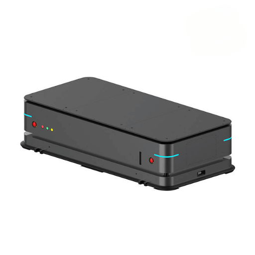
Engineers choosing between navigation methods often read about one solution in isolation and then try to compare it against another paragraph from a unrelated paper. The table below distills five mainstream AGV navigation methods into one decision matrix, scored on the seven dimensions that truly alter the total cost of ownership.
| Método | Precisão | Flexibility | Deploy Cost | Retrofit | Dynamic Obstacles | Exterior | Maintenance |
|---|---|---|---|---|---|---|---|
| Magnetic tape | ±10 mm | Low | Low | Easy | Poor | Não | High (tape wear) |
| Wire guidance | ±5mm | Nenhum | High (cut floor) | Hard | Poor | Não | Low |
| Laser + reflectors | ±3mm | Medium | Medium | Medium | Poor | Limited | Medium (clean targets) |
| Natural navigation (SLAM) | ±20 mm | High | Medium | Easy | Good | Good | Low |
| Vision-based SLAM | ±30 mm | High | High (compute) | Medium | Good | Poor (sunlight) | Medium |
Read the matrix by asking which drawbacks you are able to accept. A high-volume, fixed-route beverage logistics center with unchanged rack configuration is an ideal use for wire guidance—the inflexibility is a feature, not a flaw. A contract manufacturer with recurring production cell changes can ill afford to recut floor channels or move reflectors, and natural navigation invariably prevails on total cost of ownership. Unlike an autonomous car system for public roads, an indoor AGV must detect subtle changes in coverage light levels. Vision-powered SLAM exhibits the lowest hardware bill of materials but folds under direct sunlight and deteriorates accuracy against plain surfaces such as newly-painted warehouse walls. For 2024-era deployments, lidar-powered natural navigation lies at the efficiency advantage point for 70% of industrial AGV and AMR fleets.
Key Specs to Evaluate: What Actually Matters on the Datasheet
A positioning lidar datasheet shows a dozen specs, but four of them count in real-world performance: detection range, angular accuracy, scan frequency, and lighting resistance. The table below compares the characteristics of QJKH’s YB27 high-performance sibling—the H series engineered for intense industrial missions—and an industry-proximate mid-tier 2D industrial lidar.
| Especificação | Why It Matters | QJKH YB27-H Series | Typical Mid-Tier Industrial LiDAR |
|---|---|---|---|
| Faixa de detecção | Determines stopping distance at vehicle speed | 25 / 35 / 40 m @ 70% reflectivity | 10–30 m @ 70% reflectivity |
| Resolução angular | Sets point cloud density and SLAM match quality | 0.1° (default H models) | 0.25°–0.5° |
| Scan rate | Sets reaction time to moving obstacles | 20–50 Hz adaptive | 5–20 Hz fixed |
| Imunidade à luz ambiente | Whether the sensor survives outdoor sun or dock lighting | 100,000 lux | 10,000–40,000 lux (indoor bias) |
| Distance accuracy | Determines SLAM pose confidence | ±2 cm typical | ±3–5 cm |
| Scanning angle | Covers blind spots on vehicle footprint | 270° horizontal | 190°–360° |
| Ingress protection | Dust, water, and cleaning water resistance | IP65 | IP65 |
| Temperatura de funcionamento | Cold storage / outdoor yard compatibility | −10 to +50 °C | 0 to +40 °C common |
The hiding factor that most buyers neglect: ambient light immunity. Many 2D industrial lidars list a 10,000 to 40,000 lux rating, suitable for a dim workshop aisle but impossible at the moment a vehicle passes a lit open loading bay in daylight. A 100,000 lux performance number—the statistic publicized for the QJKH YB27 range—indicates the sensor can stomach direct diffuse sunlight without dodgy echoes, the chief factor behind spurious halts when indoor-qualified AGVs are tasked for outdoor use. If any part of your route escapes the building, this spec outweighs an additional 5 meters of range.
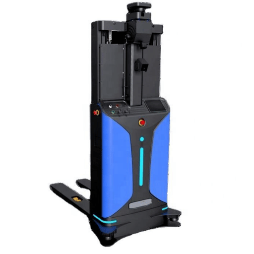
Autonomous forklifts and reach trucks are the toughest use-case for a positioning LiDAR. The machines travel faster than an average AMR, so the sensor needs to see farther ahead; they operate outdoors as often as they do indoors, so the sensor needs to be resistant to direct sunlight; and they relocate pallets and loose loads, so the sensor needs to see bumps, vibrations and temperature swings during a 12-hour shift.
Imagine a 12,000 sq ft outdoor logistics yard where a fleet of autonomous reach trucks unload inbound trailers and stage pallets for pickers in the warehouse. At two m/s of forward velocity and a three second response time in the event of a hard stop, the vehicle needs a minimum of six meters of standoff from the obstacle and additional margin for path-correction to reach a delivery target, a square 30 m in front of it. A 15 m indoor LiDAR cannot provide that margin. The long-range outdoor positioning LiDAR configuration most yards deploy is the YB27-40HE – a 40 m detection range, 0.1 angular resolution, Ethernet UDP output and the 100,000 lux immunity that remains immune to noon sunlight.
⚠ Common Mistake: Deploying an Indoor LiDAR Outdoors
Every single one of these failures occurs within a week. First, sunlight saturation: the direct 2000 lux sunlight arriving in the afternoon bleeds into the photodetector, causing phantom returns which are misclassified as pedestrians by the fleet controller. Second, temperature drift: the sensor was rated for 0 to +40 C and begins drifting when the tarmac hits 55 C in the middle of the summer, corrupting distance readings at the edge of the detection field. Third, rain backscatter: the 905 nm laser reflects off rain droplets and the scanner pegs at an alarm threshold, creating an impenetrable wall of obstacle data while there isn’t any. Every one of these flaws are correctable with the right environmental rating on the initial order.
Can a Single LiDAR Cover Both Indoor Warehouse and Outdoor Yard Operations?
Absolutely – if you buy the sensor keeping that environment in mind. A positioning LiDAR that is rated to survive under 100,000 lux ambient light, from -10 C to +50 C operating temperature, and the IP65 ingress protection spec will work inside without any fiddling because its set of operating conditions is a super-set of the indoor specs. Ordering one outdoor-rated unit instead of two different indoor and outdoor ones makes life easier for maintenance, warehousing and operators, and reduces the fleet BOM. It isn’t more expensive if the QTY is high enough, and the bonus can be delivered on day one.
Indoor AGV & AMR: Warehouse and Manufacturing Deployments
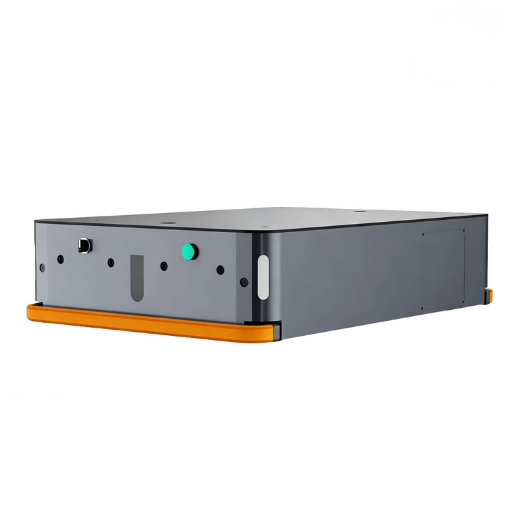
Indoor AGV and AMR fleets are the fastest-expanding part of the mobile robot industry, and the requirements for the positioning LiDAR are in some ways different from the outdoor forklift case. Indoor vehicles move at between 1 m/s and 1.5 m/s, work in tight aisles, share the floor with humans and other robots, and must be able to call upon accurate obstacle detection at any time.
During a typical indoor deployment, the sensor is commanded over Ethernet UDP to publish navigation data to the SLAM stack and a discrete obstacle-avoidance output signal over PNP to the vehicle motion controller. The QJKH YB27-25HD satisfies this use case with a 25 m detection range, 0.1 resolution capable of good feature extraction for localization, 0.3 resolution for obstacle work, and 16 pre-programmed zone groups that the vehicle can toggle between using four out-of-band external inputs – handy when going between wide open aisles and tightly parked docking stations and many a driver will check a box to grab the one that makes changing states of the operating enviroment easier.
Engineering Note — Dynamic Zone Switching Response Time
The YB27 family ships with a configurable response time that trades speed for dependability. At the fastest setting, a 2-scan mode triggers an output transition in about 67 ms – fast enough to react to a worker stepping off a pallet jack at walking pace. At the most conservative setting, a 16-scan mode waits 536 ms before triggering, which prevents most false stops caused by brief optical transients like glare from a laminated floor. The typical deployment will sit in the 2- to 4-scan band because it’s a good compromise of reaction speed vs false-stop rate.
A very common up-front mistake is to treat obstacle avoidance and navigation as a single problem. They may use the same point cloud but run on different clocks: navigation needs high-fidelity data a few times per second, obstacle avoidance only needs a coarse binary about 25 times per second. The dual-output navigation LiDAR models are optimized for this application because they will kill two birds with one $purchase here,they eliminate the costs of two sensors and cut the challenges of synchronising multiple sensors out of the dock.
Selecting a Positioning LiDAR: An 8-Point Checklist
Before you request a quote, walk through these eight questions. Each translates directly to a line item on any legit datasheet, each has a clear answer that will hold up under procurement review.
- 2D or 3D lidar? 2D is good for almost 80% of AGV and AMR use cases because the plane it scans can usually do enough to localize on wall edges. Get 3D only when scanned overhead obstacles, multi-level mezzanines, or cluttered ceiling layouts dictate robots reason in vertical as well as horizontal dimensions. The fact that the price and processing resource costs for 3D are tangible is also true – do not buy it unless it needs it.
- Detection range essentials. 15 to 25 m for tight indoor aisles, 25 to 35 m for open warehouses with wide racks, and 40 m or greater for outdoor yards and autonomous forklifts. Not enough and the vehicle gets phantom stops near the edge of the field; too much and you’re wasting resolution where it is most needed.
- Angular resolution. 0.1 is the incumbent for navigation stacks that need precise feature extraction. 0.3 is plenty fine for obstacle avoidance because you only need to be reliably told that there’s something in the zone, not accurately located in free space.
- Scan rate. 20 to 25 Hz is acceptable for sub-2 m/s vehicles. Jump to 40 or 50 Hz if the AMR will approach 4 m/s, and verify the rate is constant through the entire field of view – some sensors advertise a peak scan rate that is only sustained at a lower angular resolution.
- Ambient light immunity. This is the single most often ignored specification in fleet procurement. Request 100k lux for outdoor or dock-facing routes, 40k lux for mixed-use interior with skylights, and no less than 10k lux for any industrial deployment. Datasheets that omit this number are deliberately doing so.
- Output interface. Ethernet UDP when the point cloud supports a ROS or SLAM system. PNP or NPN discrete outputs when the sensor is part of a more traditional PLC safety system. RS232 for legacy controllers that are incapable of UDP frame rates. Models with both interfaces mean you can consolidate the sensor family onto a single part number, tying the safety and navigation components together.
- Dual-output functionality. A sensor publishing simultaneously an obstacle-avoidance stream and a navigation stream, eliminates one sensor from the BOM, one connector from the wiring harness, and one integration variable from the software stack. For any AGV or AMR with a payload below 2 tonnes, a dual-output lidar will likely be the best choice.
- Safety pairing. A positioning LiDAR is not a safety device. For any vehicle operating in close proximity to people, the risk assessment will dictate a certified safety laser scanner running through the GPS misalignment near-field space – most likely an IEC 61496 Type 3 device delivering SIL 2 and PL d. The simple-to-specify integrations use a factory-matched pair from the same manufacturer, guaranteeing common power, mounting, and configuration parameters. QJKH’s YB27 series was designed specifically to be paired with the type 3 safety laser scanner from the same series, removing the inter-vendor integration hazard that sinking-builds have.
Explore the QJKH YB27 Positioning LiDAR Series
QJKH ( a brand of CCH Shanghai Sensing Intelligence Technology Co., Ltd.) produce the YB27 family – dToF positioning LiDARs suitable for AGV, AMR, and autonomous forklift navigation. Five detection ranges (15, 25, 35, and 40 meters) are available across seven variants with 0.1 angular resolution on the H-product series, which features 270° scanning, 100,000 lux ambient light immunity, and dual Ethernet plus PNP output configurations. Building on 20+ years of industrial sensing engineering experience at CCH Shanghai, the YB27 family is intended as a simple plug-and-play navigation sensor with warehouse AMRs, outdoor autonomous forklifts, and service robots that require outdoor-ready ranging performance, without the expense of a laser triangulation retrofit.
Explore the QJKH YB27 Series →
or
Request a free sample
·
Download the YB27 spec sheet (PDF)
Perguntas frequentes
Um LiDAR de posicionamento é igual a um scanner a laser de segurança?
Ver Resposta
No. Posicionamento LiDARs são otimizados para a qualidade dos dados de navegação; eles não são comprovados para IEC 61496 para realizar funções de segurança e não podem executar uma tarefa de segurança. emparelhar com um scanner a laser de segurança certificado.
Ver Resposta
O LiDAR 2 D é bastante capaz de fornecer navegação natural para cerca de 801TP3 T de aplicações AGV e AMR O plano de varredura horizontal fornece geometria de parede, coluna e rack suficiente para extrair recursos SLAM e calcular uma estimativa de pose, enquanto a nuvem de pontos 2 D é pequena o suficiente para ser processada de forma confiável em tempo real em hardware embarcado de baixa potência O LiDAR 3 D só é necessário quando o ambiente natural inclui mezaninos de vários níveis, bloqueio de transportadores aéreos, dutos baixos não capturados por um sensor 2 D ou mudanças de elevação do terreno ao ar livre Para um armazém padrão com piso plano, limites de corredor óbvios, o 2 D é significativamente menos caro e muito mais confiável que a fragmentação em 3 D raramente torna o caso de negócios.
Qual faixa de detecção os AGVs internos versus empilhadeiras externas precisam?
Ver Resposta
As rotas AGV e AMR internas padrão de 1 a 1,5 m/s com corredores estreitos são acomodadas com faixa de detecção de 15 a 25 m. As empilhadeiras autônomas externas e os caminhões de alcance exigem de 35 a 40 m ou mais porque a distância de frenagem aumenta com a velocidade do veículo e as rotas externas mais longas terão uma ou mais zonas de transição ao ar livre.
Ver Resposta
Yes, within limits. Advanced SLAM stacks now separately classify static and dynamic features and add them to the location estimate with different coefficients, so small locations changes and re-aisle reshuffles will not result in the system losing traction. Larger changes (reaming an entire aisle, relocating OEE equipment, re-piling a big storage module) will require a quick remap run where the co-operating vehicle drives the altered area once with the operator in manual control. The update only takes a few minutes which explains in part why natural navigation is displacing reflector triangulation in fleets that reconfigure more than twice a year.
Ver Resposta
Yes – dual-output LiDAR sensors can publish a navigation point cloud and a separate obstacle avoidance signal from the same scan, reducing hardware and wiring complexity.
Transparency Statement: The specifications quoted in the article are derived from the published QJKH YB27 series datasheet (2026-01-30 edition) for the H-performance variants, and from the peer-reviewed AGV and AMR localization research cited in the References. The value ranges obtained from the mid-tier competitor datasheets are composite numbers that reflect the performance envelope common to those broad product ranges. Never just take the quoted specs at face value; check them against the supplier datasheet and your own test conditions before placing a fleet order.
Referências e fontes
- Mobile Robot Market Forecast: AMR Growth Analysis – Interact Analysis
- Advanced 3D Navigation System for AGV in Complex Smart Factory Environments – MDPI Electronics (2024)
- AI-Based Approaches for Improving Autonomous Mobile Robot Localization – ScienceDirect (2025)
- GPS-Denied LiDAR-Based SLAM — A Survey — IET Research Journals (2024)
- NAV310 Product Data Sheet – SICK AG (for reference design envelope comparison)
- IEC 61496-1:2020 – Electro-sensitive Protective Equipment classification (International Electrotechnical Commission)
Artigos Relacionados
- Industrial Safety Laser Scanners: A Standards-Based Guide to Hazardous Area Protection
- AGV/AMR Obstacle Avoidance LiDAR – Complete Selection Guide (coming soon)
- Warehouse Robot Safety Matrix – Scanners, Curtains, and Controllers (coming soon)
- Service Robot LiDAR Sensor Guide – Delivery, Cleaning & Inspection Robots (coming soon)
- Collaborative Robot Safety Laser Scanner Applications (coming soon)