Entrez en contact avec la société QJKH

LiDAR vs radar is, at its core, one engineering trade-off: LiDAR resolves shape via a dense 3D point cloud, while radar resolves speed and pushes through fog. For an industrial machine detection problem – an AGV crossing a load dock, a gantry crane tracking a load, a collaborative robot working in the same space as people – this difference can be between seeing the edge of a pallet and simply seeing… a return. This guide reviews both on accuracy, range, weatherability, price and application to help identify use cases where one may be preferable or even better to combine the technologies. (Updated June 2026).
Short answer: LiDAR sends a near-infrared pulse of light (905 to 1550 nm wavelength), times the echo, to generate a millimetre-accurate 3D point cloud. Radar sends out a 24 to 77 GHz pulse of radio waves, measuring the shift in return frequency to determine range and speed. LiDAR is better for object shape and resolution, while radar is superior for weatherproofing and speed measurements.
Key takeaways
- Even a radar capable of seeing a meter-wide target at 50 meters can’t distinguish between a person’s leg and a static bollard – the cross-section illusion.
- While our industrial LiDAR systems can resolve shapes to the nearest 2-10 millimeters, mm wave radars have a resolution of only 50-200 mm and lack the ability to determine shape.
- “Radar always wins in bad weather” isn’t completely true, however, as although near-infrared LiDAR can still operate successfully in mild weather conditions, radar offers a clear advantage in terms of effectiveness in heavy fog, rain or smoke.
- A single 270-degree lidar system can cover the field of vision equivalent of approximately eight ultrasonic sensors; hence a higher upfront purchase price often leads to reduced costs for the complete system.
- On the other hand, for person identification for mobile robots such as AGVs, standards like the ISO 3691-4:2023 and IEC 61496 are increasingly demanding the use of certified active opto-electronic devices (similar to LiDAR) over other types of sensors.
Quick Specs: LiDAR vs Radar at a Glance
| Méthode | LiDAR: near-IR laser pulses (905 / 1550 nm) · Radar: radio waves (24 / 77 GHz) |
| Précision | LiDAR ±2–10 mm · Radar ±50–200 mm |
| Range (industrial) | LiDAR 0.1–200 m · Radar 0.2–300 m |
| Field of view | LiDAR 270–360° · Radar 60–120° |
| Data output | LiDAR 3D point cloud (shape) · Radar range + velocity (Doppler) |
| Weather | LiDAR degrades in dense fog · Radar largely weather-immune |
| Coût unitaire | LiDAR ~$300–5,000 · Radar ~$200–3,000 |
Operating and measuring specifications are based on our QJKH sensor data as well as specification information related to mm wave radars.
LiDAR vs Radar at a Glance, The 4-Sensor Capability Grid
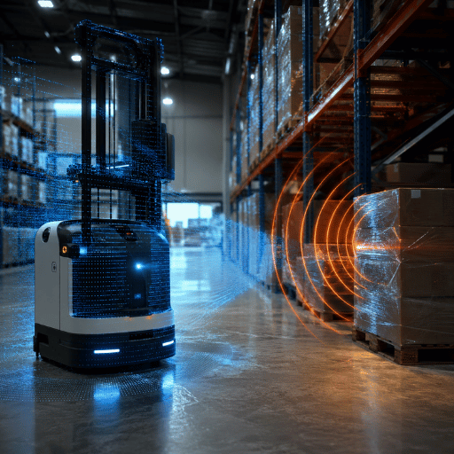
Most pages that compare LiDAR and radar limit their analysis to two options. In reality, when choosing a sensor for industrial use, you likely have four active remote sensing options – LiDAR, radar, ultrasonic, and infrared – to choose from. Our comparison uses a four-sensor capability grid, rather than the limited two-column comparison, to determine which technology best suits your application’s unique needs. At the core is a fundamental trade-off which we’ll refer to as the shape vs. speed divide.
| Sensor | Principle | Gamme | Précision | Data | Weather |
|---|---|---|---|---|---|
| LiDAR | Laser time of flight | 0.1–200 m | ±2–10 mm | 3D point cloud | Degrades in dense fog |
| Radar (mmWave) | Radio waves + Doppler | 0.2–300 m | ±50–200 mm | Range + velocity | Weather-immune |
| Ultrasonic | Sound waves | 0.02–10 m | ±10–30 mm | Distance only | Sensitive to airflow |
| Infrared / PIR | Thermal radiation | < 10 m | Presence only | Motion / presence | Affected by heat |
QJKH source – published sensor specs on LiDAR, radar, ultrasonic, infrared sensors.
Since both lidar and radar employ similar methods for active remote sensing, our comparison of these technologies presents their opposite strengths instead of classifying them as competitors. While lidar relies on the principles of light to characterize the physical attributes of an object, radar primarily uses radio frequency energy and is resilient to atmospheric interference. Few pages on the distinction between LiDAR vs. radar will include four options from a single manufacturer, but here at QJKH, we provide a four-sensor capability grid as we understand the question is rarely “should I use Lidars or Radars?” in a generic sense, but rather “should I use Lidars or Radars in this specific lane, dock, cell, or other space?”. Picking the wrong sensor here is the most common and costly mistake, because each one fails differently — so QJKH benchmarks all four against ISO 3691-4 person-detection requirements before recommending one. We’ll break down each factor in the table below:
How LiDAR Works (Light Detection and Ranging)
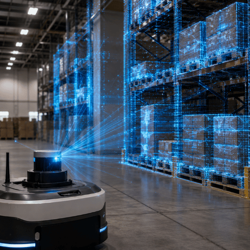
LiDAR — short for light detection and ranging — operates by emitting a laser pulse and timing the return. With light speed a known constant, the time it takes to return converts to range. Because lidar systems emit tens of thousands to millions of laser pulses per second, they capture 3D data of whatever surrounds them, creating a 3D “point cloud” of any landscape or structure.
LiDAR uses laser light as an active form of remote sensing to detect objects and fix their position in space. The trade-off is that this millimetre precision depends on clean optics: because near-infrared light scatters in dense fog, a LiDAR’s range can drop and create a detection risk just when an outdoor robot needs it, which is why eye-safe Class 1 designs certified under ISO and IEC 60825-1 standards dominate industrial use and why QJKH engineers specify them for shared workspaces.
Each industrial lidar system comprises three components: a laser light source (usually 905 nm or 1550 nm), a scanner that precisely angles and redirects the laser light as it moves across the environment (like a spinning mirror or mems micro-mirror), and a detector that catches reflected light to convert it to digital data and ultimately position and image. Time-of-flight measurements of distance gives lidar millimetre class accuracy. If long distances are required in demanding outdoor environments, the 1550nm laser offers increased pulse power with inherent eye-safety properties.
📐 Note d'ingénierie
With the exception of a few industrial applications, industrial lidar generally uses Class 1 lasers in compliance with IEC 60825-1. That makes the laser light “safe under reasonably foreseeable conditions of use”, without the need for specialized protective eyewear. When ordering safety scanners that are intended for use in areas shared by humans, make sure the devices bear a Class 1 rating, and note the laser wavelength (905nm is the more common, less expensive choice, but 1550nm provides better range and safety margins.)
Lidar stands for light detection and ranging, and lidar systems operate the same way whether they are airborne lidar systems on a drone or fixed lidar devices that use light to range on a loading dock: lidar operates on reflected light, so the shorter the time it takes for a pulse to return, the closer the object. Because lidar provides detailed 3D data, lidar excels where shape matters — lidar can detect a person’s outline, not just their presence, and that lidar data lets autonomous systems classify objects. That is why the applications of lidar span autonomous driving, autonomous cars, self-driving cars, 3D mapping and warehouse safety.
We use that dense point cloud and lidar technology for industrial applications like our industrial lidar sensors for safety and security, autonomous driving, and 3D mapping. Interested in how these industrial LiDAR sensors do it? Check out this explanation of how a 3D LiDAR sensor builds volumetric data instead of flat scan images.
How Radar Works (Radio Detection and Ranging / mm wave)
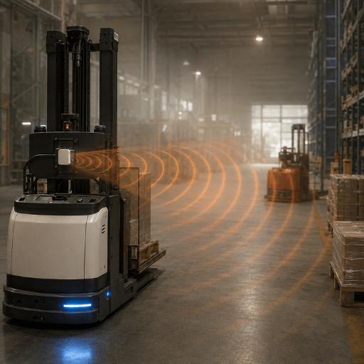
Radar — radio detection and ranging — operates like LiDAR but uses radio waves rather than light. Radar relies on radio waves to detect objects: it sends radio waves that hit a target and reflect back to the radar unit, then measures both their flight time and any frequency shift. That Doppler shift lets radar report an object’s speed in a single measurement, whereas lidar can’t.
Radar systems use a band of radar wavelengths across the radio frequency spectrum, and because a radio wave is a long electromagnetic wave that penetrates obstacles unlike visible light, longer radar waves see through conditions that blind optical sensing technology. Radar can detect objects and their velocity at once, producing radar data that pairs range with speed for other sensors to use. Typical automotive and industrial radar systems use the 24 GHz and 77 GHz millimeter-wave bands. Radar’s weakness is resolution: because the radio wavelength is long, two objects 30 cm apart can blur into a single return, which is a real problem when a safety function must pick a person out of clutter. That structural limitation is the reason QJKH pairs radar with a certified laser scanner rather than relying on radar alone for person-detection.
Does radar or lidar have a shorter wavelength?
LiDAR has the much shorter wavelength. Light waves in LiDAR are in the ~700-1550 nanometer range, while radio waves used in radar have wavelengths from roughly 0.3-100 cm. This disparity is the origin of almost all of the subsequent differences between the two technologies: short waves “see” small things (LiDAR), while long waves “blast through” the haze (radar). Radar exchanges detail for penetration.
Modern radars are generally frequency-modulated continuous-wave (FMCW) and sweep their radio frequency back and forth to determine both the range and the velocity at a single pulse; this contrasts with earlier pulsed radar simply detecting range and velocity on individual pulses. According to mm wave sensing research compiled by the U.S. National Library of Medicine (PMC), 77GHz Automotive radars can reliably “identify vehicles located 200-250 meters away” (long range is needed). Compared to lidar, radar technology also dominates traffic management, weather forecasting, and environmental monitoring, where range takes precedence over resolution. And unlike sonar technology, which relies on sound waves underwater, or passive sensors like cameras that read ambient light, radar works actively in air through nearly any weather or lighting. Radar sacrifices resolution for reach – which the next section quantifies.
Accuracy & Spatial Resolution, Where LiDAR Pulls Ahead
Is LiDAR more accurate than radar?
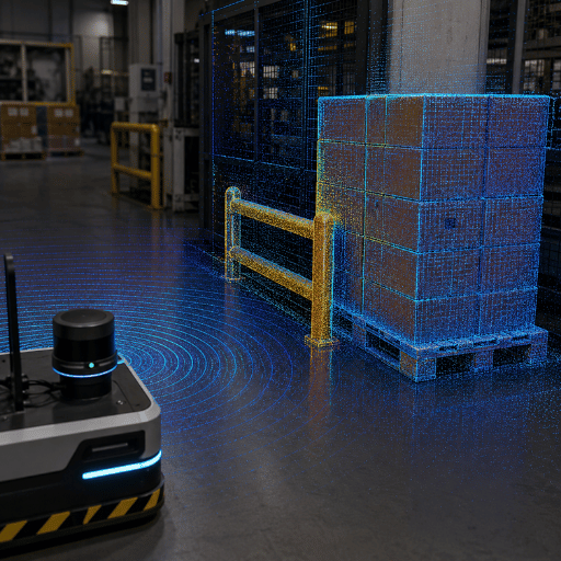
Yeah, for shape and position, LiDAR is vastly superior. For example, Industrial LiDAR has a resolution of about 2-10 mm, returns a full point cloud and costs under $5,000 for an adequate model, whereas mm wave radar returns the speed of objects (but not shape, at least not reliably or very precisely) to maybe 50-200 mm with over a hundred times the form factor and price.
This isn’t a configuration issue, it’s a physics limitation. Radar’s large wavelengths and small apertures are unable to separate points closely spaced in any dimension except their travel time (the return trip).
This is our “Cross-Section Illusion.” Radar confidently says that at the five-meter depth of field, something has roughly 1 m² in radar cross-section, but it can’t distinguish a human’s leg from a pallet edge at that same range. The system “knows” something is there but sees it in the wrong shape. Such limitations can feel painful for researchers, and they’re one of the main motivations for efforts that teach machine-learning systems to upsample radar images to a LiDAR-style point cloud — this is the kind of work that Duke’s RadCloud framework is designed to enable, since raw radar isn’t as high resolution as the scan lines of a laser.
✔ LiDAR advantages
- Millimetre accuracy and true 3D shape
- Classifies objects (person vs forklift vs rack)
- Wide 270–360° field of view per unit
- Dense point cloud for zone gating
⚠ LiDAR limitations
- Range drops in dense fog, smoke or heavy dust
- No direct velocity in a single shot
- Higher unit cost than radar or ultrasonic
- Moving parts in spinning designs (solid-state fixes this)
️️ Idée fausse commune
”More accurate is always better” is false for most things. If all that matters is that a car is approaching at 12 m/s, radar tells you in real time, but LiDAR takes multiple frames to tell you that. Accuracy matters for when shape or location affect your safe action, not your need for speed.
Detection Range & Field of View
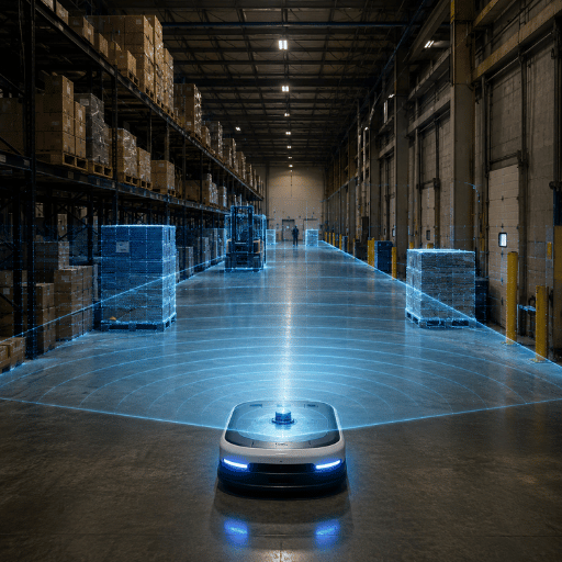
In a sense, radar penetrates the farthest – Industrial Radar covers a span of roughly 0.2-300 meters while the range of a LiDAR product falls from 0.1 to 200 meters; even longer, in fact, for some dedicated long-range surveillance RADAR products. However, range isn’t often the limiting factor indoors. Field of view is. A single 270-degree safety laser scanner covers an entire corner of the mobile robot path, where a 60-120 degree RADAR node must have siblings to cover the same area. The gap matters because every blind wedge between narrow radar cones is a place where an AGV can clip a pallet or a person, so integrators either add nodes or accept the risk. In a busy three-aisle pick zone, one 270° scanner does the job of three 90° radar nodes.
📐 Note d'ingénierie
Coverage math beats datasheet range. To wrap a 270° protective field around an AGV using 90° radar nodes you need at least 3 radar units plus the mounting, wiring and fusion logic — versus one 270° LiDAR. When you compare range, compare how many units it takes to cover the angle you actually need. Our industrial LiDAR sensor selector models this coverage math per layout.
For long-range outdoor perimeter sensing, radar’s reach and weather resilience are very real advantages. For confined indoor angular coverage – by far the most common obstacle avoidance task – LiDAR’s broad field of view generally wins in number of units/zone.
Weather & Environment, Where Radar Wins
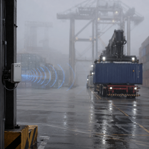
Radar’s long radio waves greatly reduce the effects of haze, fog, cloud, rain and dust, making it the fundamental standard for air traffic control and maritime navigation. LiDAR’s near-infrared laser light bounces off the same airborne particles. Both the RAND Corporation classic study on the attenuation of electromagnetic radiation by haze, fog, cloud and rain, and published US military measurements of fog attenuation at millimeter frequencies follow a similar pattern: higher frequency waves lose orders of magnitude more energy to aerosols than lower ones. The practical risk is real — in dense fog a LiDAR’s effective range can collapse exactly when an outdoor AGV most needs to see, because the laser scatters off droplets the radio waves pass through. That is the structural reason QJKH pairs a scanner with mmWave radar in fog-prone yards.
However the popular maxim “radar is always better in bad weather” doesn’t hold up: in light rain or light fog, a 905 nm LiDAR still provides usable data — experienced practitioners in robotics communities report that rain affects it much like a camera, not catastrophically. Only in very dense fog or smoke does the advantage become clear, with laser light losing around 200 dB/km in the most extreme cases. So, the true rule is conditional, not absolute. In practice, an outdoor logistics yard with seasonal fog and 200 m sightlines runs radar as its primary outdoor obstacle detection sensor, while the same operation uses LiDAR for the precise indoor docks — a split QJKH sees across most mixed-environment sites.
💡 When to let environment decide
- Clean indoors climate-controlled LiDAR; weather not an issue.
- Outdoors yard with periodic fog, welding smoke, grain or cement dust radar, or combine with both.
- Freezer with frost and condensation tests on location, both can have trouble, radar usually wins.
Cost & System Integration, The Real Total
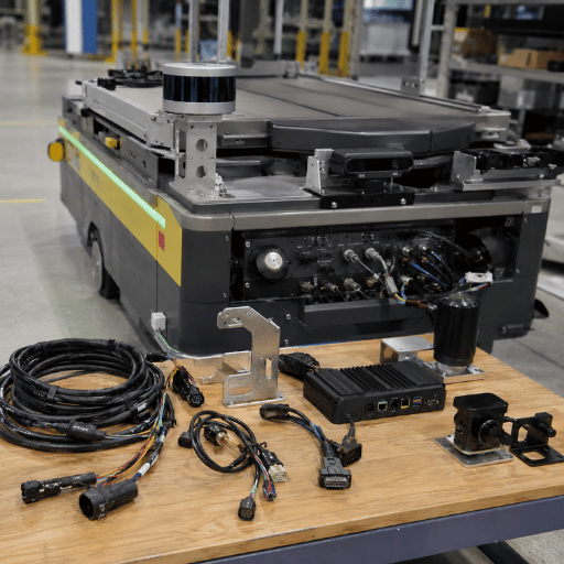
Per unit, radar is often lower cost: industrial radar costs generally $200-3,000; industrial LiDAR is $300-5,000. Exact prices depend upon quantity, model and supplier and should be checked with a current quote. Automotive solid-state LiDAR average selling prices fell over 30% between 2023 and 2025 by one market estimate, but unit value shouldn’t be the consideration when designing.
The figure that drives a project is total system cost for the coverage you need. In QJKH deployments, one 270° industrial LiDAR replaces roughly eight ultrasonic obstacle-avoidance sensors, because a single scanner sweeps the whole forward arc that eight fixed ultrasonic cones would otherwise cover. When you include the wiring, controller channels, mounting hardware and system integration time needed for that array, the single LiDAR with a higher list price often results in a lower installed cost — a lower-priced sensor that requires eight mounts is not a net saving. The trade-off only flips outdoors, where a machine shop or yard fighting dust may still need radar.
Cost factors that move the total
- Sensors per zone (field of view ÷ coverage angle)
- Controller inputs, cabling and IP-rated connectors
- Installation and programming hours (point-cloud zone gating vs simple range gating)
- Calibration and maintenance over the sensor’s life
- Certification effort for the safety function
Take a full picture before you make decisions about unit price alone – our LiDAR ROI estimator calculates the installed price across sensor quantities, and solid state LiDAR doesn’t have moving parts that rack up maintenance expenses.
Use-Case Fit, The Geometry-or-Velocity Decision Map
Which is better for obstacle detection, LiDAR or radar?
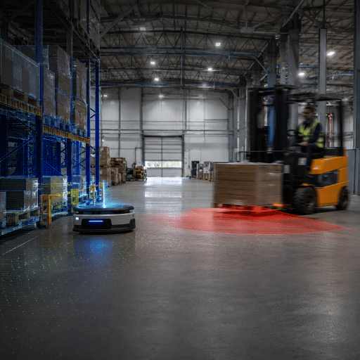
For most indoor industrial obstacle detection, LiDAR is the better primary sensor because the safety question is geometric: exactly where is the person, the rack, the load edge. Radar becomes the better choice when the environment defeats optics — dust, glare, dense fog — or when velocity is the real decision variable. The Geometry-or-Velocity Decision Map below routes the common industrial scenarios.
| Application | Environment class | Recommended sensor | Pourquoi |
|---|---|---|---|
| Indoor AGV navigation | Clean indoor | LiDAR | Wide FOV, person-detection geometry, clean air |
| Outdoor fleet in fog / dust | Harsh outdoor | Radar (or fusion) | Weather immunity, longer range |
| Gantry / overhead crane | Indoor overhead | LiDAR (2D safety scanner) | mm-level edge and intrusion detection along the track |
| Cobot / shared cell | Collaborative | LiDAR | Precise zone gating around people |
| Long perimeter security | Outdoor wide-area | Radar | Range and velocity over wide areas |
| Automotive ADAS | Mixed / road | Fusion (radar + LiDAR + camera) | Redundancy across weather and speed |
| AS/RS shuttle & stacker | Indoor high-density | LiDAR | Point-cloud collision avoidance around racking and protruding cargo |
| Pallet truck / tugger AMR | Indoor mixed traffic | LiDAR | Person detection in shared aisles, ISO 3691-4 performance level |
| Dock & yard interface | Indoor-outdoor transition | Fusion | Handles changing light and weather at the threshold |
Source: QJKH application engineering across AGV, gantry-crane and cobot deployments.
The field results mirror the map. At a 40,000 m² port distribution centre, updating an AGV fleet to LiDAR zone gating reduced false-positive emergency stops by 87% (from 4.2 to 0.5 stops per 8-hour shift across 25 days of data) because the point cloud could tell an actual personnel intrusion from a fleeting shadow. A container port crane anti-collision system recorded no near misses across 14 months when updated from ultrasonic sensing, with each prevented incident equivalent to $120,000. Work-in-process inventory and production efficiency has also been raised as work in a cobot cell increased from 62 to 91% of its capacity thanks to LiDAR zones enabling human and robot to co-locate safely and closely, without irritating shutdown.
“Buyers ask whether radar or LiDAR is ‘better,’ but on the floor the question is always geometry or velocity. If the safety case depends on knowing exactly where a person is, we specify a LiDAR scanner. If it depends on how fast something is closing across an open yard, radar earns its place, and in fog we run both.”
For crane-related guidance, see overhead crane LiDAR; for tight indoor footprints, a 2D LiDAR sensor handles single-plane protective fields efficiently.
When to Combine Both, LiDAR + Radar Sensor Fusion
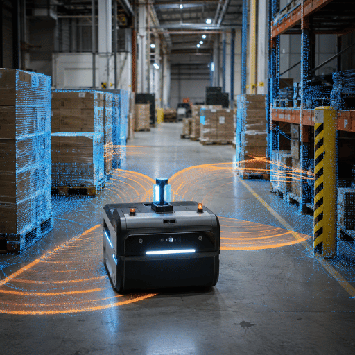
Combine LiDAR and radar when no single sensor covers every condition the application throws at it. Use fusion for outdoor AGVs, yard automation, and dock or crane work where fog, dust, or rain can blind a laser scanner but a 77 GHz radar still reports range and velocity. LiDAR supplies the certified shape and person-detection; radar adds the all-weather speed backup.
Can LiDAR and radar be used together?
Yes – and the common solution for all-condition coverage is often to marry them. Rather than being rivals, radar and LiDAR are complementary: sensor fusion pairs LiDAR’s shape and category data with radar’s speed and environmental immunity, so the system keep a usable picture when either sensor alone would fail.
There’s plenty of prior art in patent literature on this topic, for instance, a United States patent for a camera-radar fusion sensor system (US10852419B2) and a long-range steerable LiDAR system (US9880263B2) based on time of flight detection technology.
A handy industrial one-two, used in practice on outdoor AGV and yard applications, is to place the LiDAR scanner in the primary guard for accurate person-detection and mount the 77 GHz mm wave radar on the front for both velocity and an inclement-weather backup. This all has compliance significance: With an “active sensing” regulation – the sort defined in IEC 61496 – the protective product itself has to sense a person and come to rest in a safe state, which demands the known and predictable geometry of a laser scanner. Radar complements but generally can’t replace a certified safety scanner. The risk of skipping the pairing is concrete: a fog-blinded LiDAR with no radar backup can miss a moving forklift, so QJKH engineers a LiDAR-plus-mmWave pair for outdoor fleets because each sensor covers the other’s failure mode.
Industry Outlook, What’s Changing in 2026
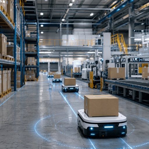
The most compelling case to revisit your sensor strategy now isn’t marketing, it’s regulatory. The 2023 edition of ISO 3691-4, the AGV/AMR safety standard, defines person-detection safety functions using standardized performance levels. Commissioning driverless trucks in 2026? Better make sure your obstacle-detectors conform to that 2023 edition. That means buying certified active opto-electronic scanners, aka LIDAR-class, instead of just a handful of tacked-on radars.
To be fair, at the higher end, LIDAR and radar boundaries have blurred in recent years. 4D imaging radar provides vertical resolution and a crude shape profile; FMCW LIDAR offers instantaneous per-point velocities. It’s a story of two technologies adopting one another’s unique advantages. Radars are finding significant application in mobile robotics where LIDAR and vision fall short (according to coverage from the Robot Report), and sophisticated radars are narrowing the performance gap with LIDAR. Meanwhile, falling costs for LIDAR due to high volume in China are accelerating a push toward LIDAR-centric fusion of sensory information. While 4D radar and FMCW LIDAR forecasts predict steep growth curves for the coming years, focus less on the sales figures and more on what the end user is facing: tighter performance standards and lower installation costs for LIDAR-based safety.
💡 What to do in 2026
Planning to install an AGV or crane safety system this year? Address ISO 3691-4:2023 first and ensure your project meets those safety performance levels, usually via a certified LIDAR scanner, supported by radar when weather conditions dictate.
Foire aux questions
What is the main difference between LiDAR and radar?
Voir la réponse
LIDAR is an optical technique. It uses near-infrared light lasers to determine range and 3D form by capturing an object’s reflection. The lasers’ tiny wavelength give it high spatial precision; LIDAR thus excels at defining shape. Radar, a radio-wave technique, can ascertain range and velocity-speed-of objects, benefiting from a longer radio wavelength’s ability to penetrate weather and precisely measure how fast an object is moving.
Can radar detect a person or small object?
Voir la réponse
While a radar can confirm the presence of a person like object and its velocity, radar has lower spatial precision. It may identify an object but have difficulty differentiating it from nearby environmental clutter, like shrubs. A safety-grade LIDAR scanner-especially a wideFOV type-is a better sensor of choice to precisely locate a person when the Safety Systemrequires it. A radar sensor then provides a supplemental backup for weather and velocity.
Do police use LiDAR or radar?
Voir la réponse
Think of LIDAR and radar in policing: a radar speed gun has wide coverage but lacks precision; a LIDAR “laser” speed gun is very precise but focused on a single vehicle in the crowd. The trade-off extends into robotics: while the narrower LIDAR laser offers pinpoint detection accuracy, the radio-wave radar delivers wide, weather-proof coverage.
Does Tesla use radar or LiDAR?
Voir la réponse
Tesla is the notable holdout. Most automakers building robotaxi and ADAS stacks budget for LiDAR, but Tesla dropped radar in 2021 and runs a camera-only “Tesla Vision” approach for driver assistance. Industrial safety is a different problem: machine-guarding standards expect an active sensor with predictable geometry, so a certified LiDAR scanner stays the reference for person-detection, not cameras.
Why does LiDAR cost more than radar?
Voir la réponse
In addition to a precise, millimetre-accurate point-cloud representation of objects, a well-placed, high-resolution LIDAR scanner has such angular accuracy it can act as the primary person-detection sensor (even though, like other cameras and radars, they have weather limitations). They require much higher optical and mechanical precision in the hardware compared with less-expensive radar transceivers. However, a high resolution LIDAR can sometimes replace many radars, lowering the overall installed system cost.
What certifications matter for industrial LiDAR safety sensors?
Voir la réponse
For industrial object detection, three safety standards come to mind. IEC 61496 specifies the electro-sensitive protection equipment; Type 3 applies to many mobile AGV cases while Type 4 is required for higher risk fixed guarding; IEC 60825-1 Class 1 certifies the laser as safe to the eyes without eye protection, and ISO 3691-4:2023 (the current edition, superseding the 2020 version) describes the minimum required performance levels for a driverless industrial truck’s safety system to detect people. These combined standards demonstrate exactly what safety performance required of the sensor to perform the detection of a human and put the machine into safe state. Be sure your certificate is for the right sensor part number and version. See QJKH’s line of industrial LiDAR sensors for certified options.
Not sure which sensor fits your line?
Match the field of view, accuracy, range and environmental conditions to your application with our LiDAR sensor selector — or talk through an all-radar, all-LiDAR, or fused obstacle-detection layout directly with our engineers. QJKH supports LiDAR, radar, ultrasonic and infrared lines, so the recommendation follows the duty cycle on your floor, not a single product family.
À propos de cette analyse
The accuracy, range and field-of-view figures in this lidar vs radar comparison come from QJKH’s published specifications across our LiDAR, radar, ultrasonic and infrared product lines, plus field results from AGV, gantry-crane and cobot deployments. Where data is open-market (unit pricing, market forecasts) we say so and qualify it. Reviewed by the QJKH technical team.
Références et sources
- Recent Advances in mmWave-Radar-Based SensingU.S. National Library of Medicine (PMC)
- RadCloud: Real-Time High-Resolution Point Cloud from RadarDuke University
- Attenuation of Electromagnetic Radiation by Haze, Fog, Clouds, and RainRAND Corporation
- 140-GHz Attenuation and Optical Visibility Measurements of FogU.S. Defense Technical Information Center
- LiDAR Safety Standards and Exposure Limits (IEC 60825-1)QuantumLABS
- System and Method for Camera Radar Fusion (US10852419B2)USPTO
- Long Range Steerable LiDAR System (US9880263B2)USPTO
- ISO 3691-4:2023, Driverless Industrial TrucksANSI
- Radar for Autonomous Mobile RobotsThe Robot Report